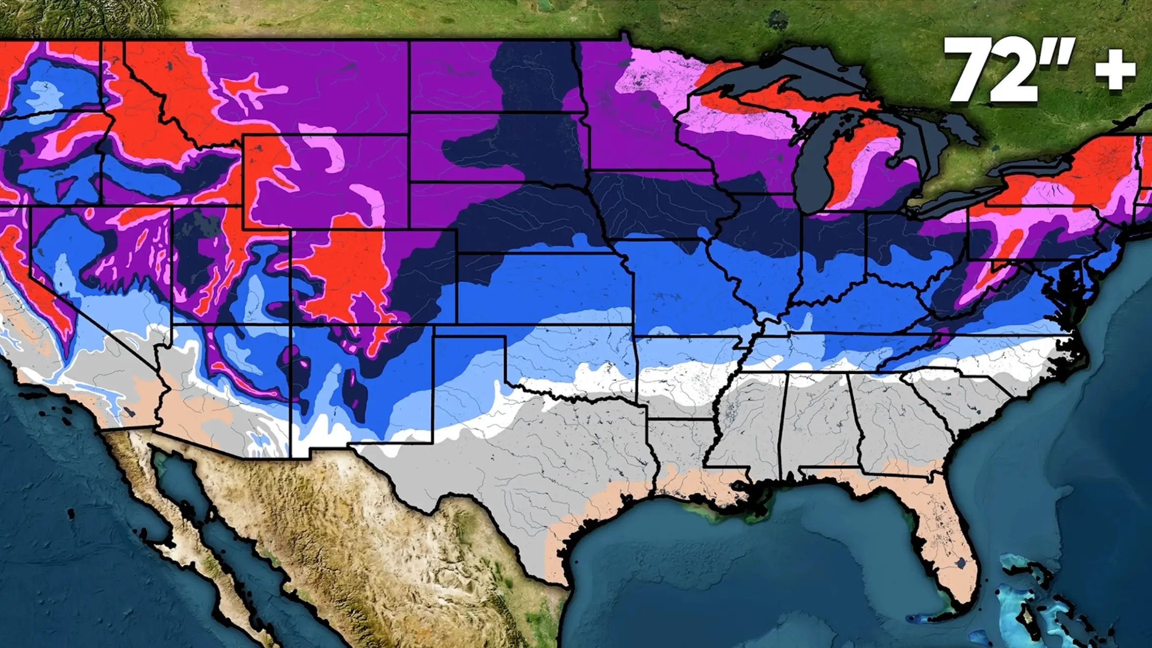
19 US states turn purple on map as historic El Niño could set stage for huge winter storms

Much of the United States is being warned to prepare for heavy winter storms as the super El Niño prepares to make its way across the country.
Heavy snowfall is predicted across the Southwest, the deep South and SouthEast regions, where above-average volumes of snow are expected to settle.
The warning comes from YouTube channel Direct Weather, which revealed that even those further north in New England should also expect above-average snowfall in addition to the usual nor'easter storms, which frequently form across the East Coast of the States.
Nor’easter storms are strong extratropical cyclones that usually form within 100 miles of the coast between Georgia and New Jersey before moving northeast. Their power comes from the vast temperature difference between cold Arctic air over land and warm water from the Gulf Stream.
Advert
Elsewhere, other parts of the country will see less snowfall than usual due to the super El Niño, including the Pacific Northwest, the Midwest and parts of the Great Plains, according to Direct Weather.
Then, the likes of Utah, Colorado, parts of southern Idaho, southern Wyoming, Indiana, and Ohio can all expect to experience their usual amounts of snow.
According to a map created by the weather channel, 19 states highlighted in purple can expect to experience extreme levels of snow this winter.
But why is the super El Niño causing such different impacts on snowfall across different parts of the country? This is where it all gets quite scientific.
A strong El Niño warms the tropical Pacific Ocean, which changes where huge amounts of tropical rainfall and heat are released into the atmosphere. That disrupts the jet stream, the fast-moving band of air that steers winter storms, pushing it south and making it stronger.
This shifts the usual storm track, meaning some parts of the US get more moisture while others get less. Where that moisture meets sufficiently cold air, it falls as snow and where temperatures are too mild, it falls as rain instead.
Meanwhile, other parts of the world are feeling the effects of the weather phenomenon in completely different ways. One example is Australia, Indonesia and parts of South Asia where severe drought is causing a greater risk of wildfires.
Another bizarre knock-on effect is the complete absence of hurricanes produced by the Atlantic Ocean in the month of September for the first time in more than three decades. The only other Septembers previously recorded with no hurricanes were 1994, preceded by 1972 and 1962.
El Niño can make conditions in the Atlantic much less welcoming for hurricanes by increasing wind shear, changes in wind speed and direction higher up in the atmosphere. This can disrupt storms before they have a chance to develop.
 Emma Rosemurgey