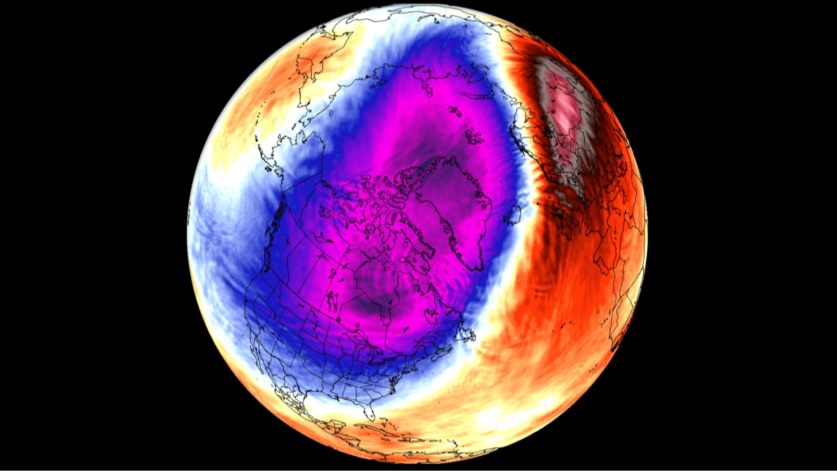
'Record-breaking' polar vortex set to swarm the US as millions of Americans face mass disruptions with warnings issued

The polar vortex, a giant band of fast-moving winds that circles the North Pole, is currently very weak and could be seriously disrupted within the next 24 hours.
That matters to Americans because a disrupted vortex can increase the chances of Arctic air spilling south into the US.
The FOX Forecast Center says the disruption could instead arrive around a week from now, and either way it could become the earliest major disruption on record.
Before anyone reaches for the snow shovel, though, forecasters stress that this does not mean temperatures are about to plummet.
Advert
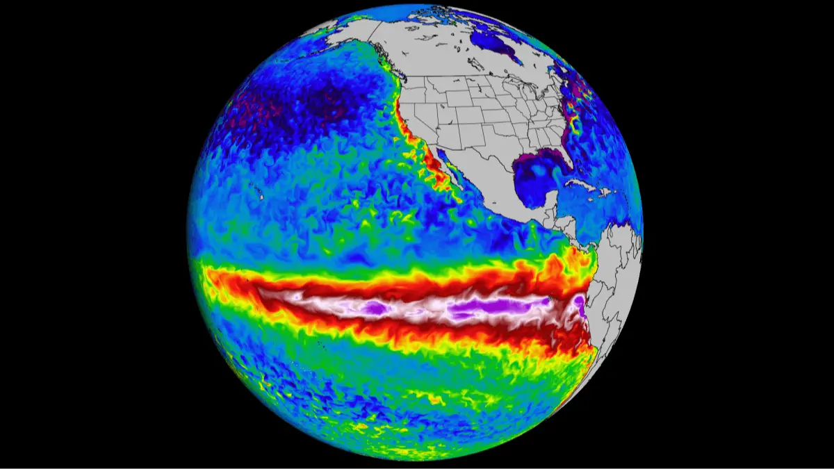
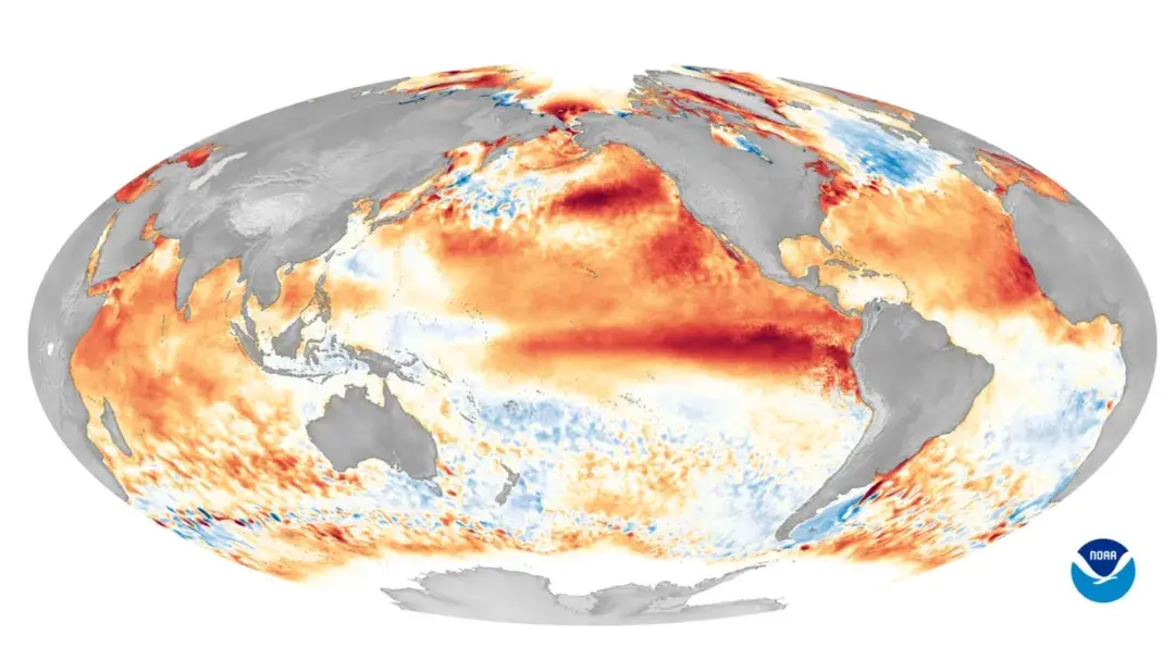
It may not mean they will drop at all, because a Super El Niño weather pattern is dominating the season and is expected to bring warmer-than-average weather to much of the US through December.
"So far, models continue to show no major cold air outbreaks in the future," the forecasters said.
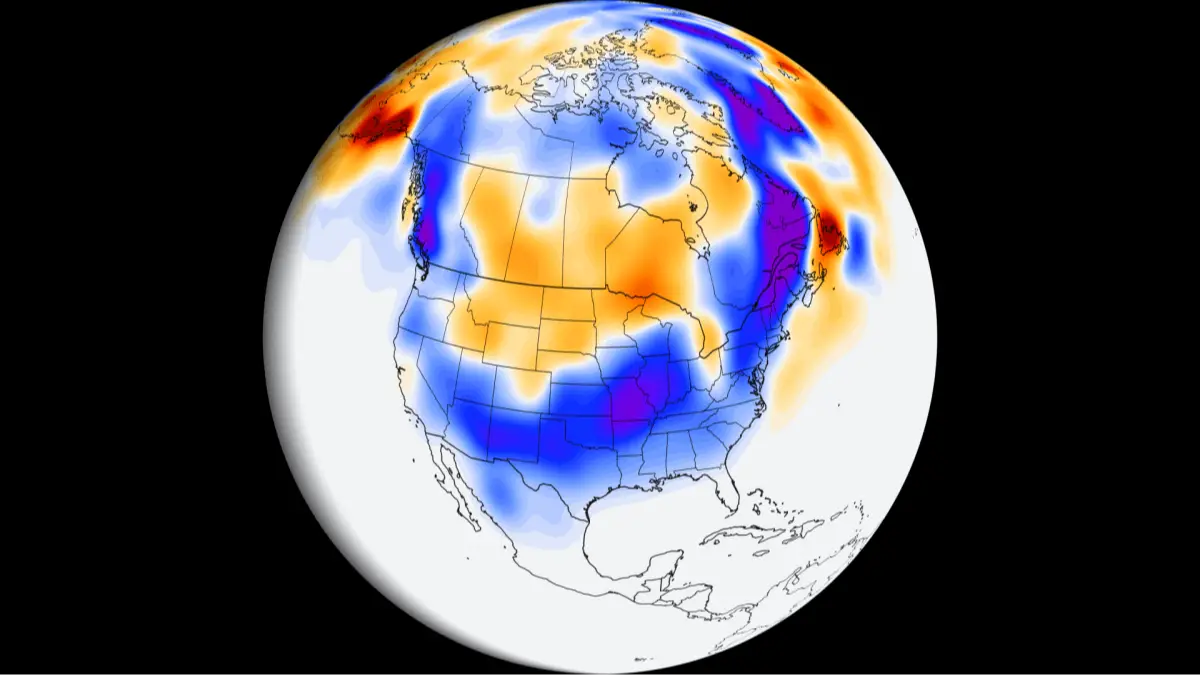
At the moment, the coldest air is forecast to gather over Eastern Europe and Siberia, while North America remains much warmer than average. That limits the chances of a lengthy Arctic spell reaching the US.
How does the polar vortex affect weather in the US?
The vortex sits roughly 10 to 30 miles above the Earth, far above the ground, and starts from around 55 degrees north latitude, which is about the latitude of Ketchikan, Alaska.
Its winds normally blow strongly from west to east.
Weather in the lower atmosphere can send powerful atmospheric waves up into that layer.
If they are strong enough, they can weaken the vortex, shift it or split it, and in some cases reverse those winds. That changes how air circulates, which is how Arctic air can end up spilling south.
The effects are far from instant, though. Changes high in the atmosphere can take several weeks to filter down and influence the jet stream, the fast-moving air current that steers weather systems, as well as wider weather patterns. So even an earliest-on-record breakdown does not necessarily bring colder air sooner, with any potential impacts across North America more likely toward late November or December.
Will the US have a cold winter this year?
That is the question behind a head-to-head contest this winter between the polar vortex and the Super El Niño.
With a warmer winter predicted, the vortex could break down earlier than ever, sending cold air into the US.
Only time will tell whether the Super El Niño's warmer-than-average pattern comes out on top or the vortex wins out.
From next week, a stronger and more active jet stream over the Pacific is expected to carry mild air across the country. That pattern would support above-average temperatures and make it harder for colder air to settle in for long.
The Climate Prediction Center's long-range forecasts point the same way, favoring above-average temperatures through December across much of the northern US, including the Pacific Northwest, Northern Plains, Upper Midwest, Great Lakes and Northeast.
Brief cool spells remain possible, but the overall pattern currently favors a milder-than-average November and early winter.
Topics: Climate Change, El Niño, Environment
 Thomas Bamford