NASA satellite discovers strongest sign of Super El Niño as prediction of devastating impact increases
Topics: Weather, World News, NASA
Topics: Weather, World News, NASA
New data released by NASA has revealed a precursor for an El Niño event as the world prepares for extreme weather conditions this summer.
Reports of a so-called 'Godzilla' El Niño have been swirling for some time now, but The World Meteorological Organization (WMO) admitted that models it was analyzing were showing mixed predictions about the strength of it.
Celeste Saulo, the secretary general of the WMO, recently said: "There are models that are not providing any indication of a strong El Niño, while others are doing so."
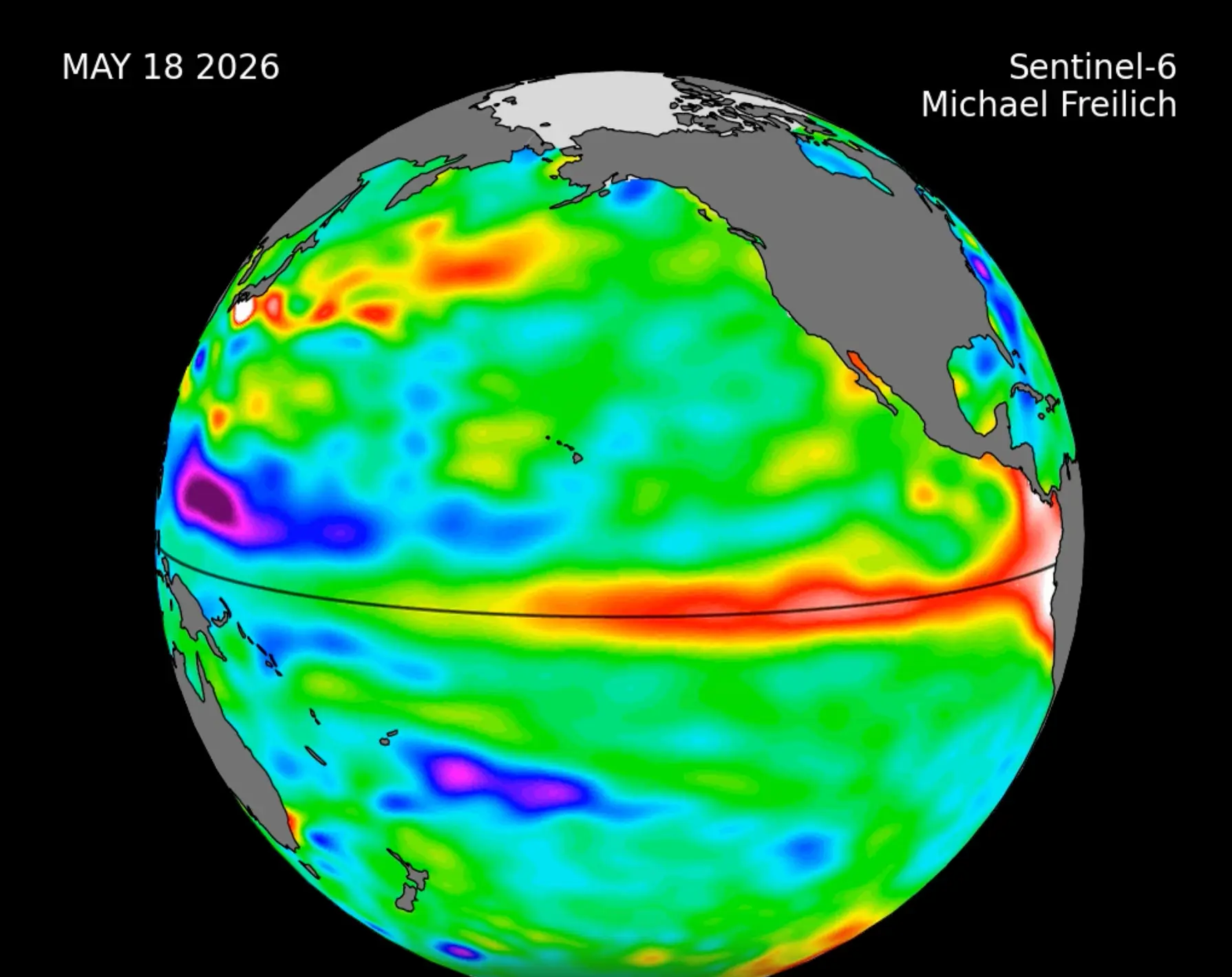
But now NASA has collected data from the international Sentinel-6 Michael Freilich satellite that could indicate that an El Niño weather event (which typically takes place every two to seven years) is on its way.
Advert
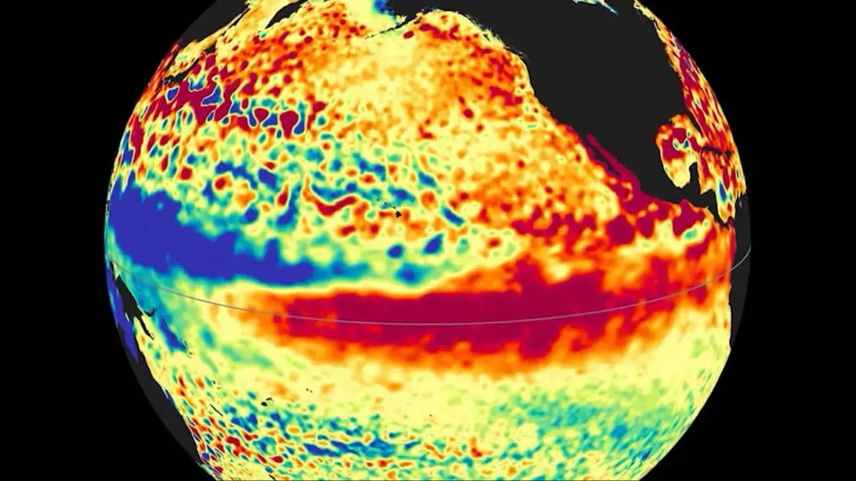
The data, collected between March and May, showed 'higher, warmer water moving from the western Pacific Ocean to just off the coast of Colombia, Ecuador, and Peru', NASA said in a press release.
The space agency further explained: "This phenomenon is known as a warm Kelvin wave, signified in this animation of the data by yellow, orange, red, and white.
"The emergence of Kelvin waves in the early part the year is a signal that an El Niño event is likely to follow."
In mid-May it was found that Peru's waters were 5.9 inches (15cm) higher than long-term averages. NASA said of this: "Because water expands as it warms, a rise in elevation of an area of the ocean indicates increasing temperature."
El Niño events can affect the world's weather significantly, says the National Weather Service, and can cause warmer and dryer conditions than usual in parts of North America and Canada. In contrast, the US Gulf Coast and Southeast experience wetter weather and have increased flooding.
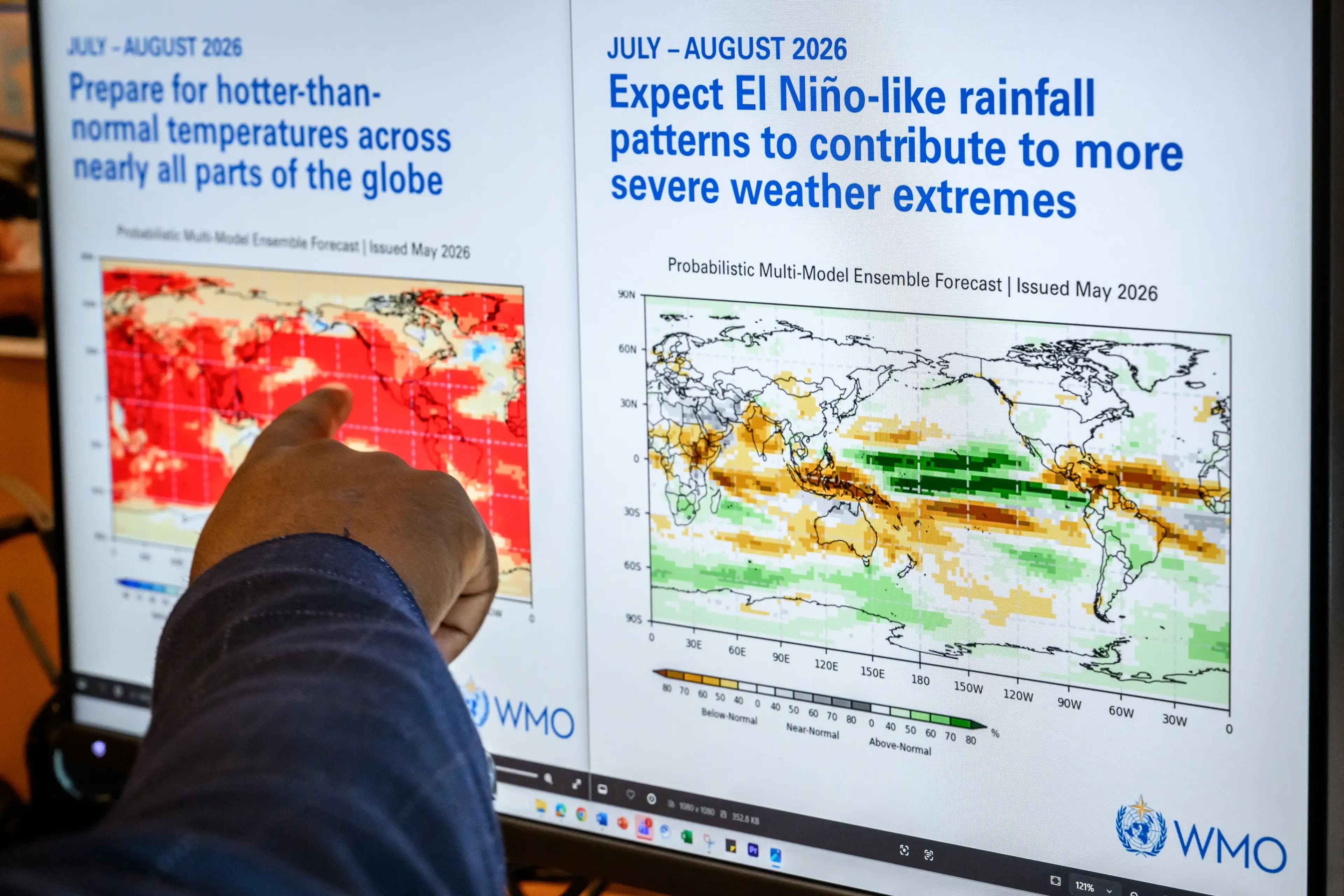
While NASA said El Niño is 'likely', it did not give a timeframe of when we might expect it to hit. The WMO has though, and shared that El Niño has an 80 percent chance of forming before September, and a 90 percent chance before November.
Off the back of this, UN Secretary-General António Guterres has shared his concerns about this year's forecasted El Niño.
"The science is clear: El Niño is arriving on our doorstep in the coming months with 90 percent certainty. The world must treat it as the urgent climate warning it is," he said.
Guterres continued: "El Niño conditions will pour fuel on the fire of a warming world. Impacts will hit even harder, travel even farther, and cross borders with devastating speed.
"The only effective response is climate action equal to the crisis – ending the addiction to fossil fuels, accelerating the shift to renewables, protecting the most vulnerable, and delivering early warning systems for all."

Strap in, folks. It’s time for some science.
It all starts with something called trade winds, which are permanent winds around the equator which usually blow from east to west. So in the equatorial Pacific, they blow from the Americas towards Australia and New Zealand.
As the wind blows the water east, it is warmed by the sun, so by the time it gets to the other side of the Pacific, the warm water causes hot air to rise, leading to warm, wet and unsettled weather. Meanwhile, colder water from deeper in the ocean rises in the east to replace the water blown west.
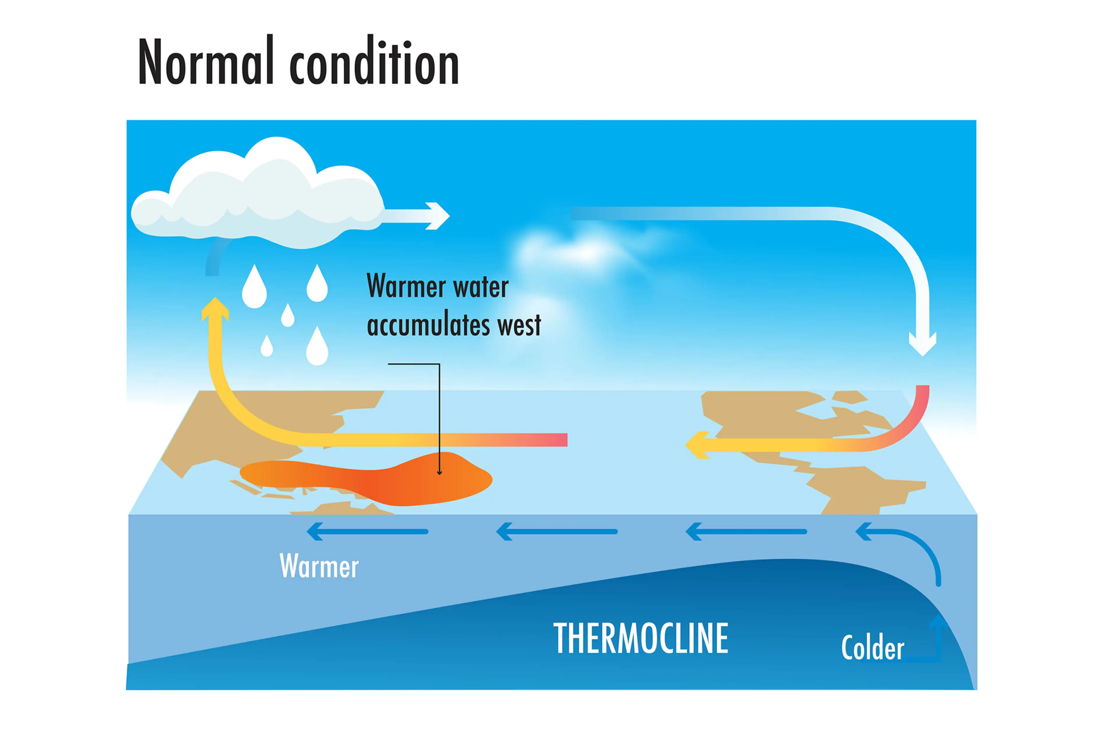
But during El Niño years, this gets disrupted.
When trade winds are weakened or even reversed, the temperature difference between the east and west is cancelled out, and usually cold parts of the ocean warm up.
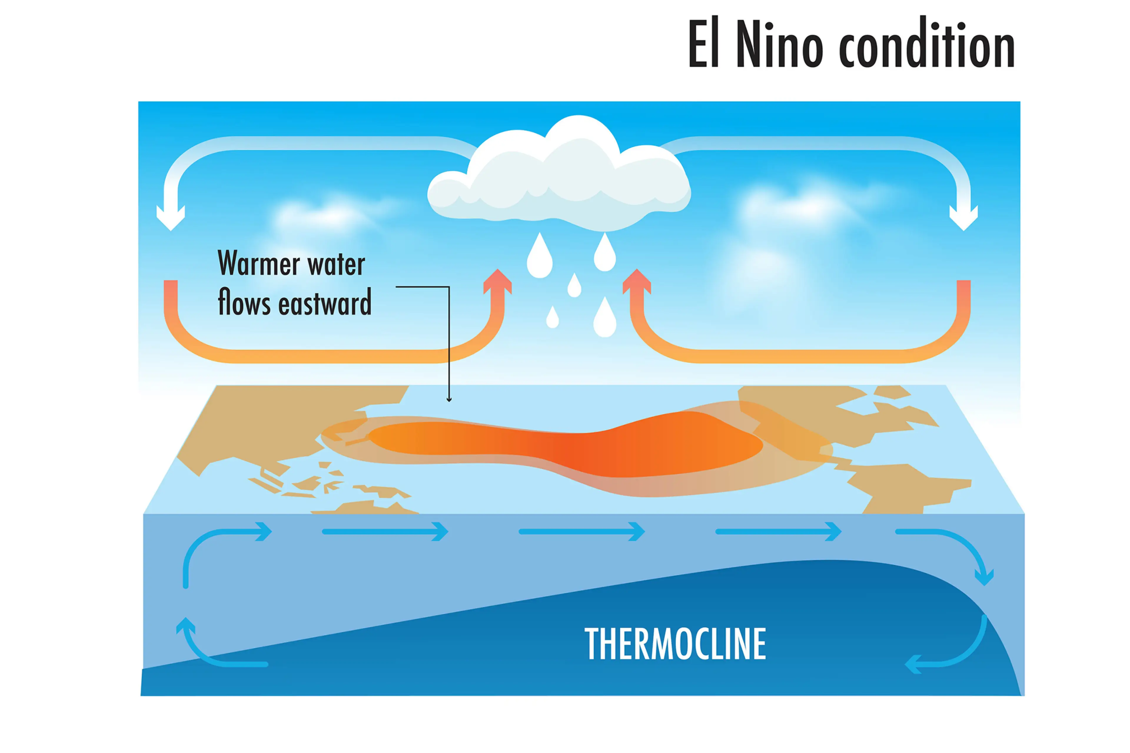
Rainfall and wind patterns change across the equatorial Pacific, which has a knock-on effect around the world.
Anyone else's head hurt a bit?