UN issues 'urgent' warning about El Niño as it makes prediction on when it could arrive
Topics: Science, Weather, World News
Topics: Science, Weather, World News
The United Nations has warned people to take the imminent return of El Niño seriously as the natural climate pattern could have a huge impact our planet.
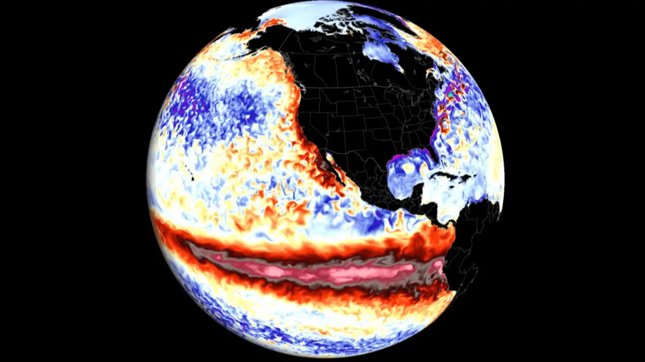
El Niño occurs when the surface waters of the central and eastern tropical Pacific Ocean become unusually warm. These events can occur every two to seven years and typically last between nine and 12 months.
El Niño can cause extreme weather events; something the globe has been experiencing in recent years as a result of climate change. The last one the world experienced was 2023 to 2024.
While El Niño is nothing new, forecasters have warned that the upcoming weather pattern could be the strongest El Niño in at least a decade, per National Geographic.
Advert
Reports in April suggested that the the pending El Niño has a 25 percent chance of being 'very strong', and a 50 percent change of being 'strong'.
Scientists monitor four different things when it comes to El Niño: surface temperature of the ocean, atmospheric pressure, winds, and rainfall in the equatorial Pacific.
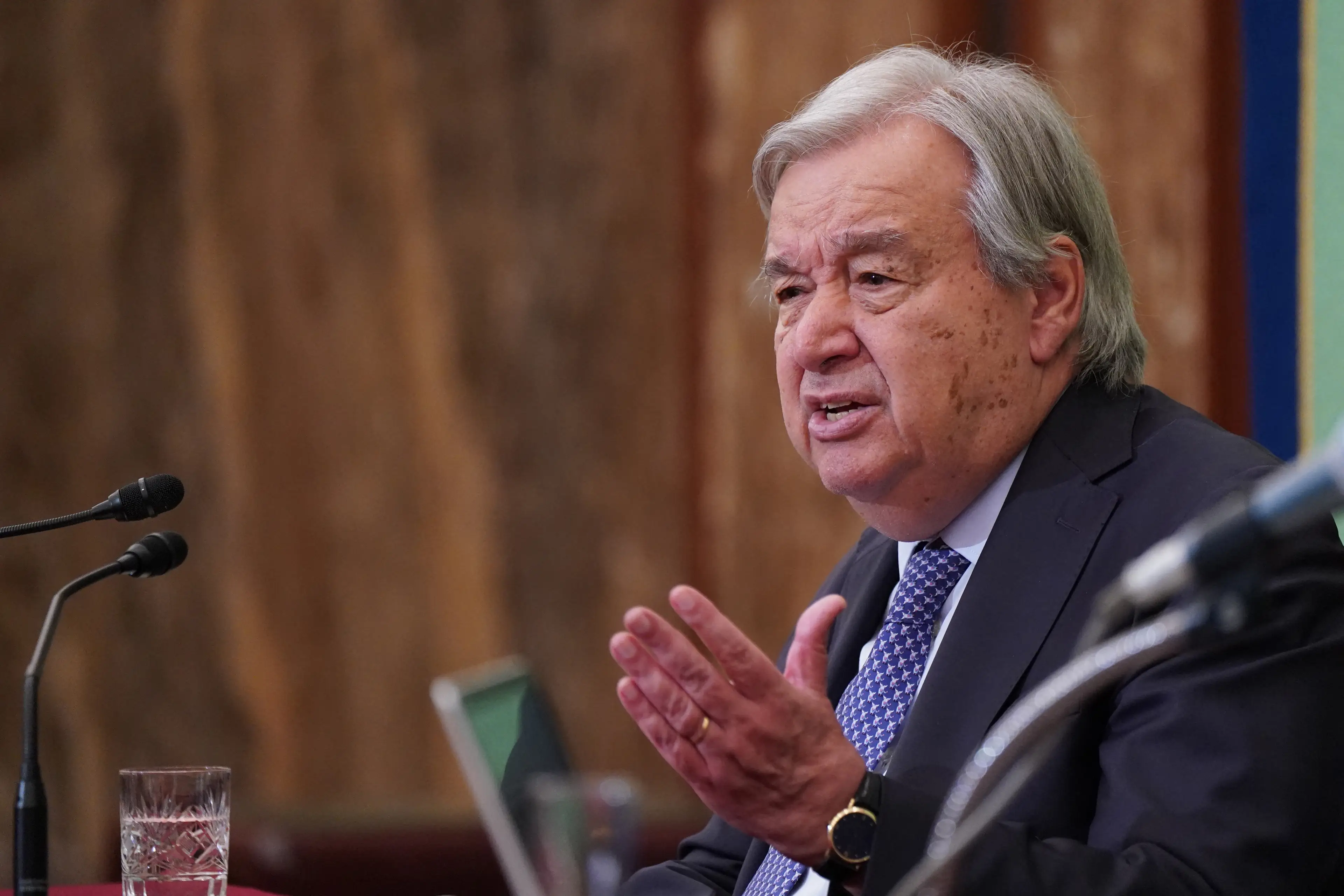
The World Meteorological Organization (WMO), which is part of United Nations, issued a statement on June 2 about El Niño and warned that people should take it seriously.
António Guterres, the UN Secretary-General, said, per The Guardian, that the world 'must treat it as the urgent climate warning it is'.
He continued: "El Niño conditions will pour fuel on the fire of a warming world. Impacts will hit even harder, travel even farther, and cross borders with devastating speed."
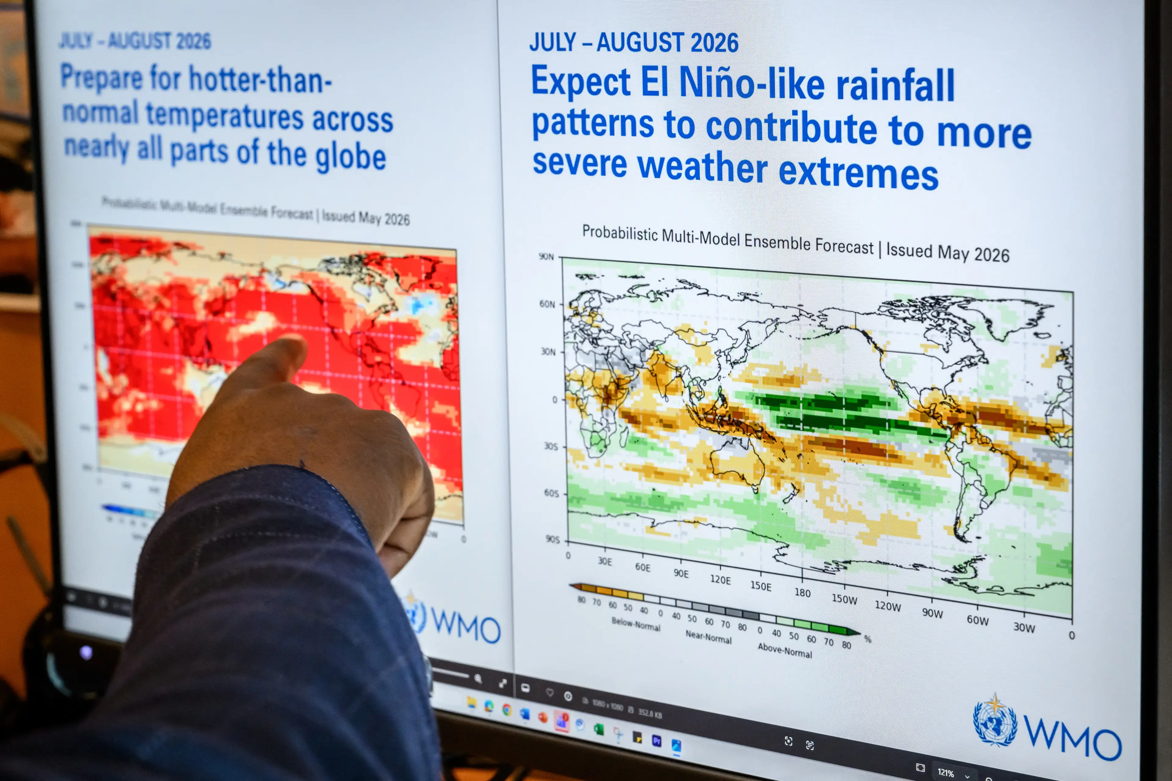
The WMO says that El Niño has an 80 percent chance of forming before September, and a 90 percent chance before November.
The weather event could then return as soon as next year.
It's expected that most of the globe will experienced unusually high temperatures over the next three months, while extreme rain and droughts have also been predicted.
Heavy rain is likely to hit parts of South America, the southern US, the Horn of Africa and central Asia, while droughts usually impacts Central America, northern South America, the Caribbean, Australia, Indonesia and parts of south Asia.
While it appears as if a so-called 'Super El Niño' is pretty certain, the WMO admitted that it has struggled to fully back the predictions.
Celeste Saulo, the secretary general of the WMO, said: "The spread is large. There are models that are not providing any indication of a strong El Niño, while others are doing so."
Strap in, folks. It’s time for some science.
It all starts with something called trade winds, which are permanent winds around the equator which usually blow from east to west. So in the equatorial Pacific, they blow from the Americas towards Australia and New Zealand.
As the wind blows the water east, it is warmed by the sun, so by the time it gets to the other side of the Pacific, the warm water causes hot air to rise, leading to warm, wet and unsettled weather. Meanwhile, colder water from deeper in the ocean rises in the east to replace the water blown west.
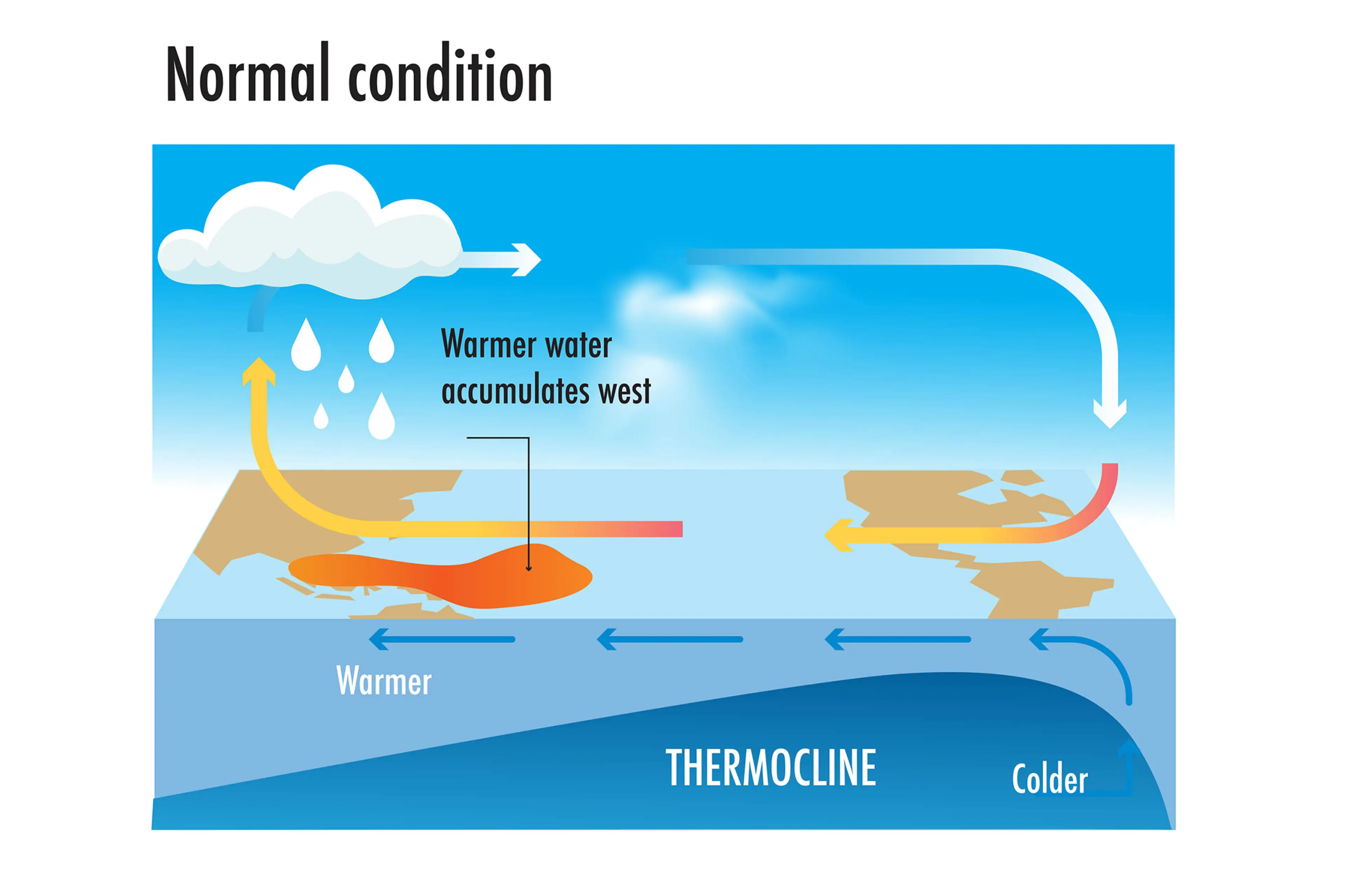
But during El Niño years, this gets disrupted.
When trade winds are weakened or even reversed, the temperature difference between the east and west is cancelled out, and usually cold parts of the ocean warm up.
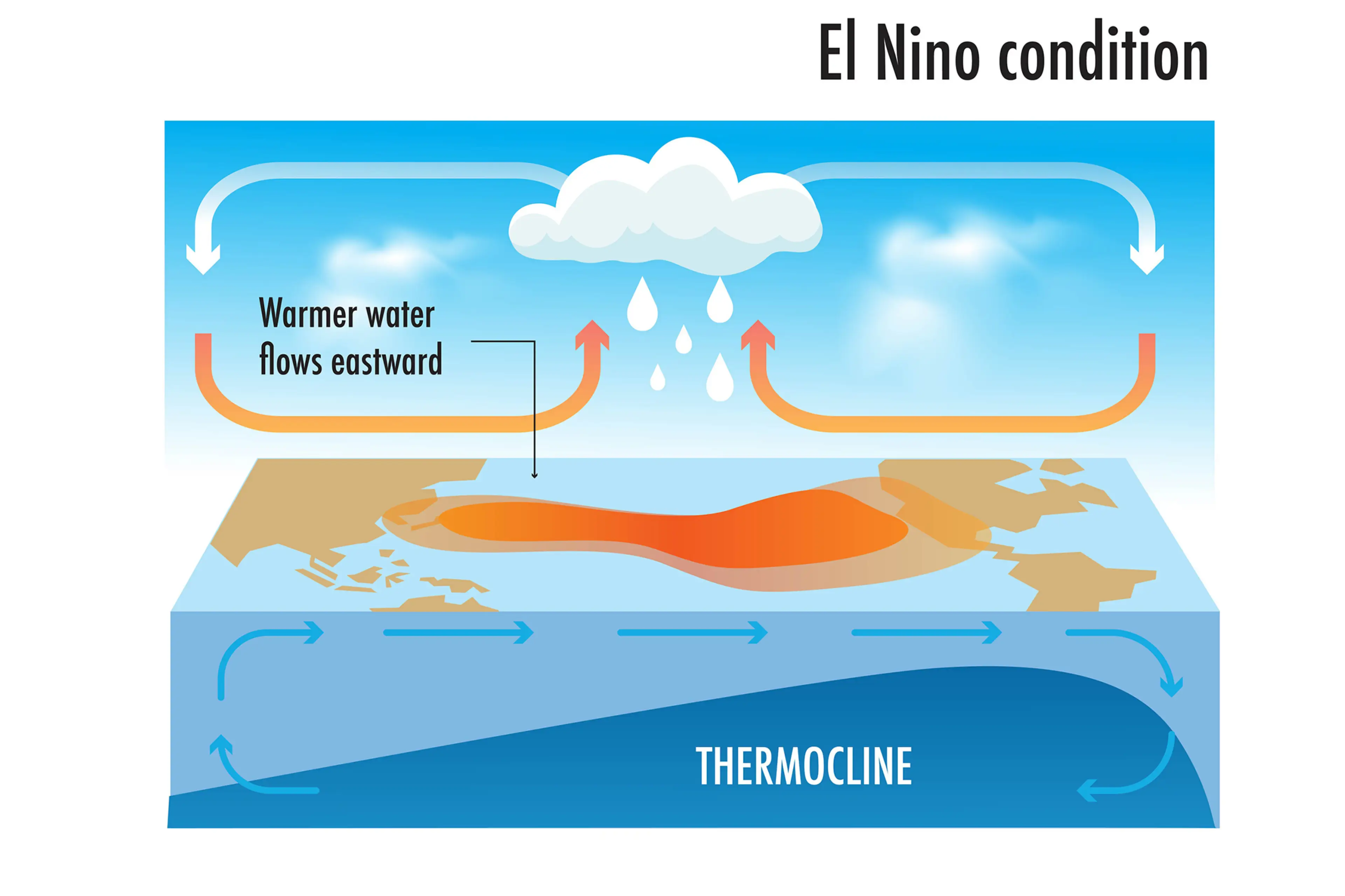
Rainfall and wind patterns change across the equatorial Pacific, which has a knock-on effect around the world.
Anyone else's head hurt a bit?