When El Niño is expected to peak as experts warn it's 'strengthening'

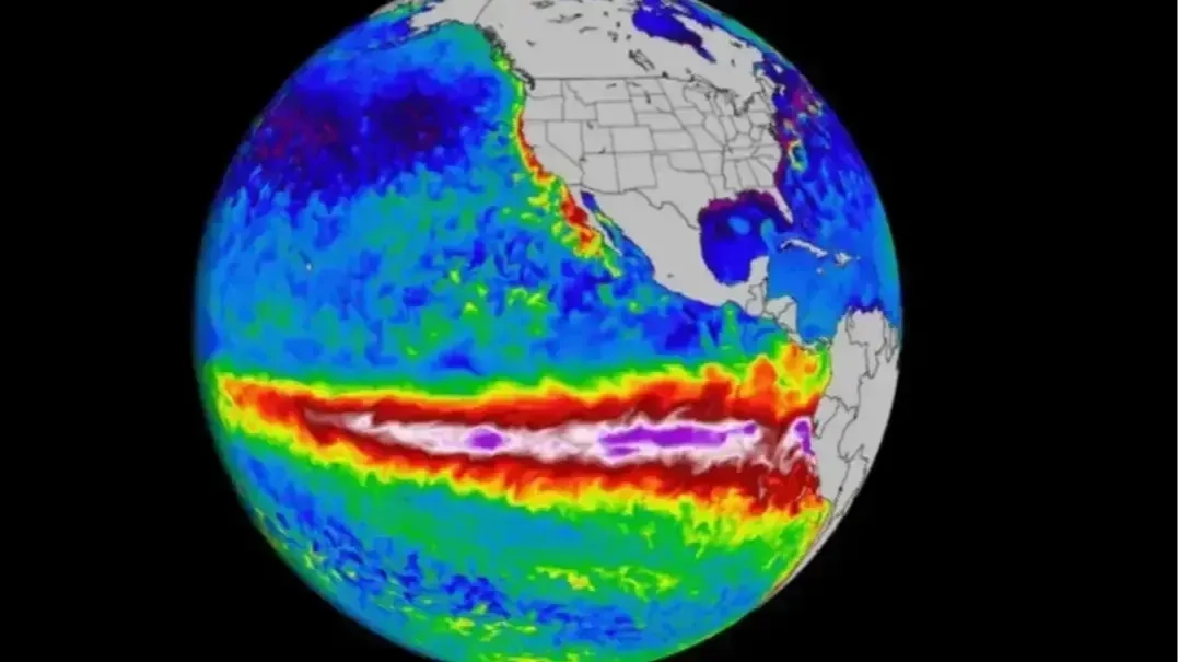
El Niño's expected peak has been predicted following sea level temperatures having already risen higher than previous records set in 2015.
The natural climate cycle has built up quite the reputation, nicknamed the 'Super' El Niño and even acquiring the nickname 'Godzilla'.
And it's certainly living up to these titles too, the current El Niño pushing the surface waters of the central and eastern tropical Pacific Ocean up to unprecedented levels, prompting extreme weather events including hurricane warnings and even a 'winter storm battleground'.
El Niño is the extreme warm phase, joined by the cold phase, La Niña, both making up The El Niño-Southern Oscillation (ENSO). The World Meterological Organization (WMO) notes: "Both El Niño and La Niña generally begin developing between March and June and reach their peak intensity between November and February."
Advert
But when can we expect to see the current 'Godzilla' El Niño's peak given daily sea surface temperatures in the central-eastern Pacific have already overtaken records of 2015, measuring 3.05°C above average on 19 September - compared to 3.02°C 11 years ago, as per the BBC.
Well, the WMO updated last month that we should prepare to lock in for a rocky few months...
When El Niño is expected to peak
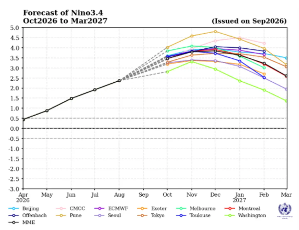
In its September 2026 El Niño/La Niña Update it confirmed 'a nearly 100 percent likelihood that El Niño will persist through September–November 2026 and December 2026–February 2027'.
Australia's Bureau of Meteorology (BOM) revealed the current El Niño is already at 'near-record levels'.
"The latest weekly relative Niño3.4 index value for the week ending 11 October 2026 is +2.81°C, well above the El Niño threshold (+0.80°C)," it explained.
The WMO warned forecasts indicate it's only expected to strengthen further in upcoming months, 'with the event forecast to reach very strong intensity before peaking towards the end of the year'.
It predicts the 2026 El Niño will peak with a sea-surface temperature increase of 3.7 °C around December and that this will persist through February.
But how could this impact the weather?
The wider impact of increased sea-surface temperatures of El Niño
This will lead to an increase in 'the likelihood of above-normal temperatures across much of the world, driving significant shifts in rainfall patterns,' WMO’s monthly Global Seasonal Climate Update states.
"Combined with exceptionally warm global oceans and the likelihood of a positive Indian Ocean Dipole, the El Niño is expected to shape weather patterns across many parts of the world in the months ahead," it noted.
This could include heightened risks of extreme heat, floods, and drought.
Increased heat, as WMO’s Secretary-General, Celeste Saulo, explained to Huffpost: “El Niño doesn’t add new heat to the planet. It releases heat the ocean has already been storing beneath the surface – which is why a strong event so often becomes one of the hottest years measured (as with 2024).
“The ocean it’s drawing from is the warmest we’ve ever measured it. There is simply more heat available to release.”
Topics: Weather, World News, El Niño, Climate Change, Environment
 Poppy Bilderbeck