Map shows the nine states strongest El Niño in our lifetime will hit hardest this winter

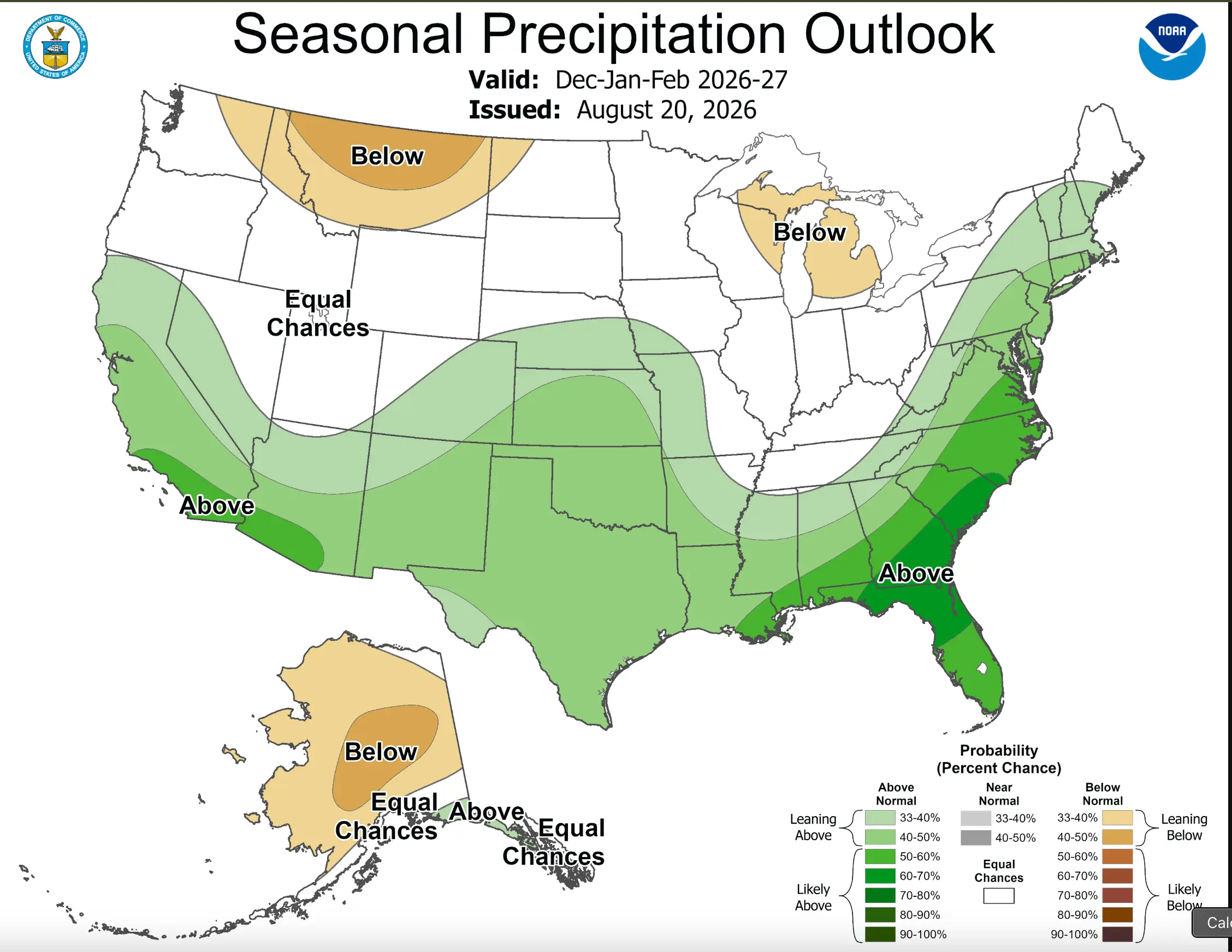
A new forecast map has laid out exactly which parts of the US are most likely to see the heaviest rain and snow this winter, as one of the strongest El Niño events in decades continues to strengthen in the Pacific.
According to the National Oceanic and Atmospheric Administration's (NOAA) Climate Prediction Center, nine states are to expect an above-normal precipitation over the coming months; Maryland, Virginia, North Carolina, South Carolina, Georgia, Florida, Alabama, California and Arizona.
The map comes as NOAA's Climate Prediction Center revealed there is now a greater than 90 percent chance of a 'very strong' El Niño event through the Northern Hemisphere fall and winter of 2026-27, with the October-to-December window carrying a 69 percent chance of an event that could exceed every El Niño on record dating back to 1950.
What is an El Niño?
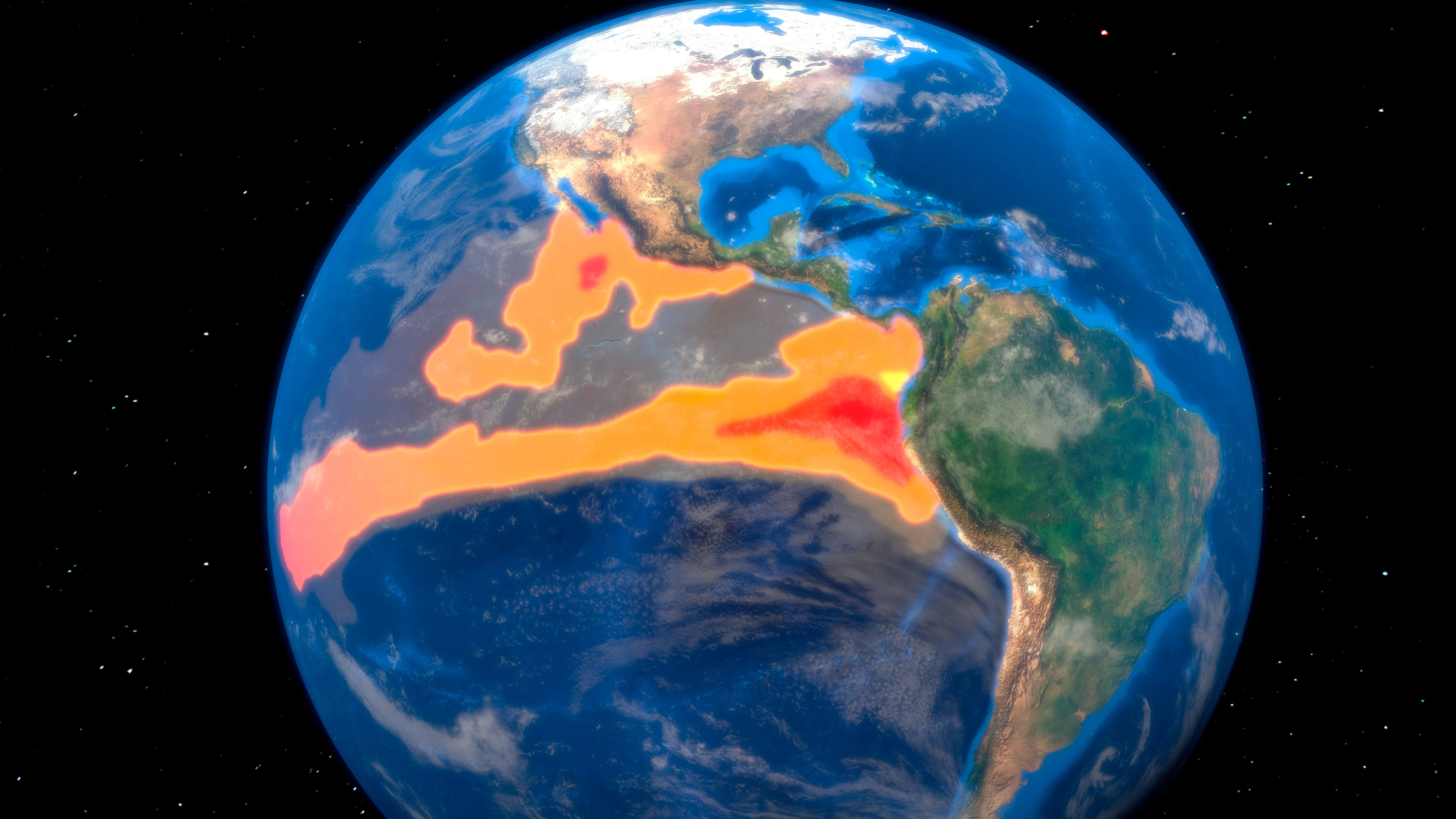
El Niño, which translates to 'little boy' in Spanish, is a naturally occurring climate pattern in which sea surface temperatures across the tropical Pacific Ocean rise well above average.
Advert
It tends to develop every two to seven years and can disrupt weather patterns across the globe for months at a time, pushing up temperatures worldwide in the process.
NOAA confirmed the current El Niño had officially begun back in June, and has said it could persist all the way through to spring 2027.
That would make it noticeably longer than the last event, which ran for around 12 months between June 2023 and May 2024.
The World Meteorological Organization (WMO), which forecasts the event is expected to peak toward the end of this year with impacts continuing well into 2027, has echoed the warning.
WMO Secretary-General Celeste Saulo said the current event has 'the potential to deliver a massive blow to communities and economies across the world.'

UN Secretary-General António Guterres said: “El Niño is being supersized before our eyes. The science leaves no room for doubt: the planet is in uncharted waters, and those waters are heating up.
"Sea surface temperatures are rising, temperatures keep climbing, and the world is in the danger zone of extreme weather.
"The race now is between rising risks and our commitment to take climate action and protect people. We must win that race."
Beyond the nine states flagged for heavier-than-normal rain and snowfall, the wider concern is the knock-on effect El Niño tends to have across the board: including soaring temperatures and intense storms to flooding, drought and extreme heat, all of which can devastate crop yields, strain ecosystems and drive up health and economic costs.
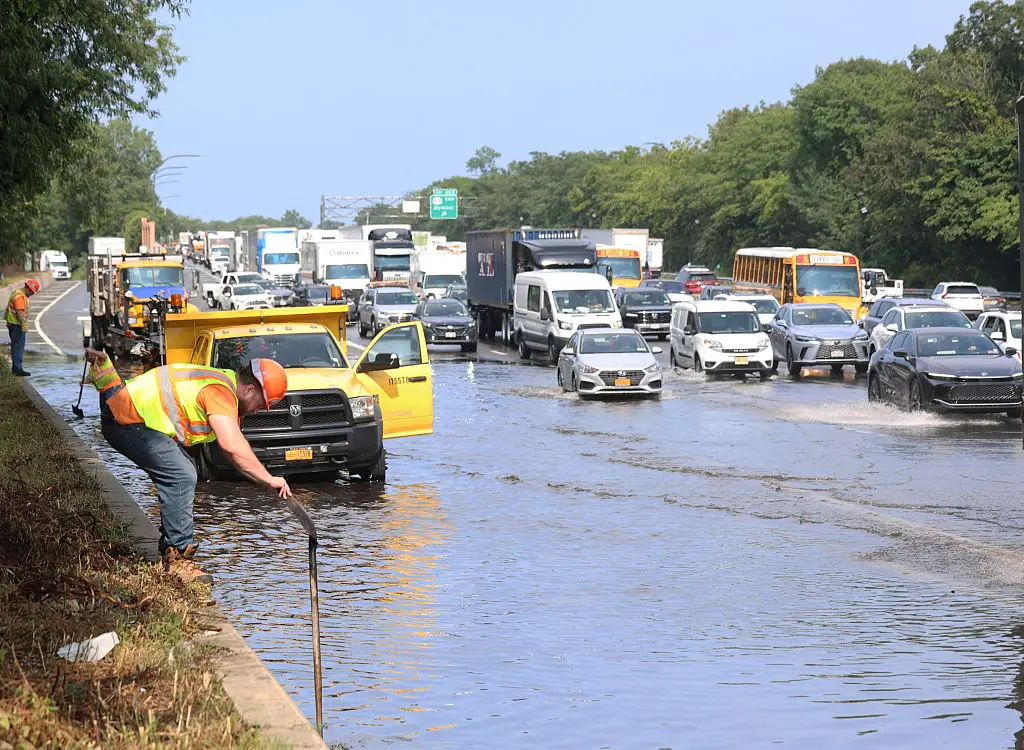
The last El Niño offers a preview of what that can look like. It intensified global heat, fuelled severe droughts and heavy flooding, triggered widespread marine heatwaves and coral bleaching, and contributed to 2024 becoming the hottest year ever recorded globally.
Saulo said the response needed to match the scale of the threat.
“This exceptional El Niño demands exceptional preparation and response,” she said, adding that never before in the WMO's 50-year history had the organization launched such a large-scale mobilization of national meteorological services to protect lives and livelihoods.
Topics: Climate Change, Environment
 Thomas Bamford