Five worst-case scenarios as Super El Niño could hit US in weeks
 Britt Jones
The Super El Niño is almost guaranteed to start anytime from now until August, and with that, comes some potentially disastrous consequences to some countries around the world.
Now, you might have heard this term floating about a lot in recent weeks as researchers keep a close eye on the weather, but an El Niño is the name given to a type of climate phenomenon that occurs every two to seven years, lasting around nine months.
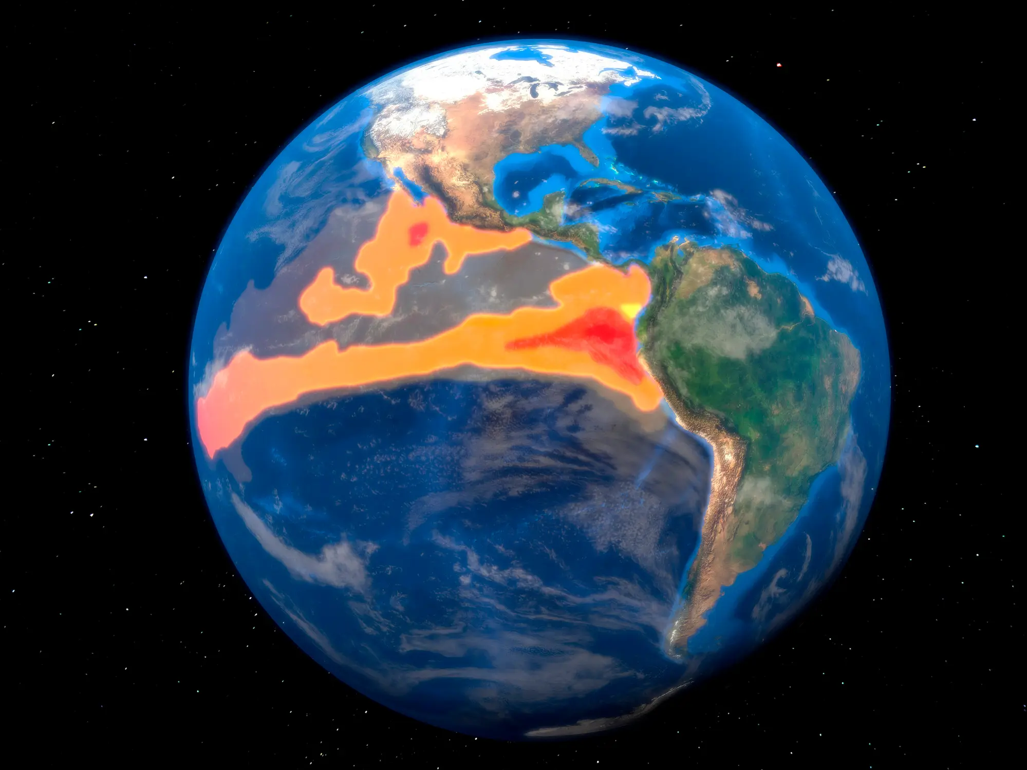
It happens when sea surface temperatures in the central and eastern Pacific Ocean become warmer than normal, causing changes in wind and weather patterns across the globe.
A Super El Niño, however, is the term given to an El Niño that stems from the Pacific waters getting to 3.6 degrees Fahrenheit above average, the NOAA states.
Advert
While the NOAA says there’s over an 80 per cent chance of an El Niño emerging in July 2026, it could happen even sooner.
If that happens, there will be signs its coming fast.
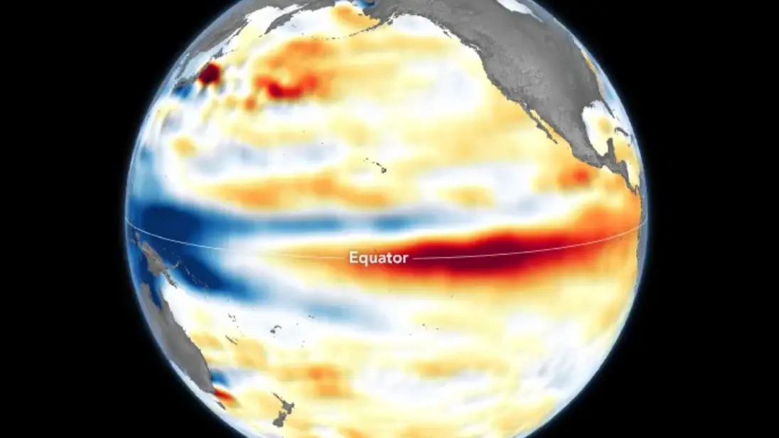
After images showed a large body of warmer water off the South American coast, it’s clear to see that this could be the extreme El Niño churning up the sea.
NASA and the US agency and European counterpart the European Space Agency, ESA, revealed images of the area from the Sentinel-6 Michael Freillish satellite, which shows the signs of the El Niño at work.
Here’s what you might see as its worst case scenarios have been revealed:
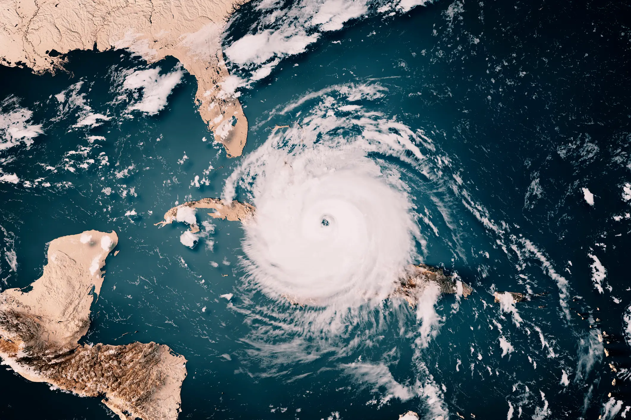
Increased hurricane activity
The Atlantic and Pacific could see increased hurricanes during hurricane season thanks to its changing sea temperatures.
This should be occurring right about now in both area, with AccuWeather predicting 2026 ‘could be an unusually active and potentially impactful year in the Pacific basin’ with around 17 to 22 storms, nine to 13 hurricanes, and four to eight major hurricanes on the menu.
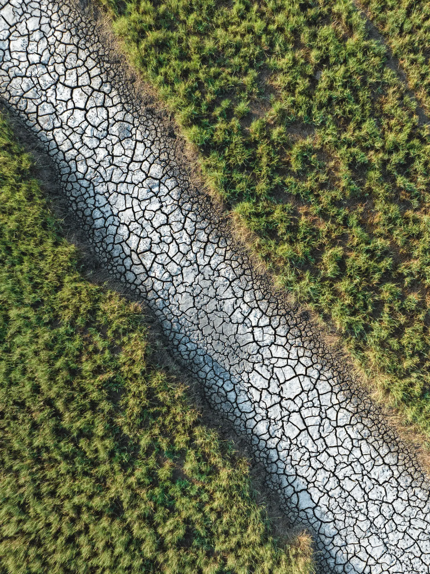
Drought
Areas of the Northwest are already in drought, with places like southwestern Idaho and Nevada, Utah and Colorado, facing the brunt, per the U.S. Drought Monitor.
Seeing less rain and more heat isn’t ideal, particularly in areas that depend on rainfall to supply its annual water supply, feed crops, and animals too.
“The stretches of dry weather can lead to a prolonged moderate to severe drought from the I-81 corridor in the Mid-Atlantic into the Southeast,” AccuWeather meteorologist Chad Merrill told NewsWeek. “Since the rain may come in large quantities over a short time period, there may not be much percolation into the soil to help the agricultural communities.”
There’s also the case of climate disasters.
Drier than average climates could also be seen in parts of the US, which then leads to another problem...wildfires.
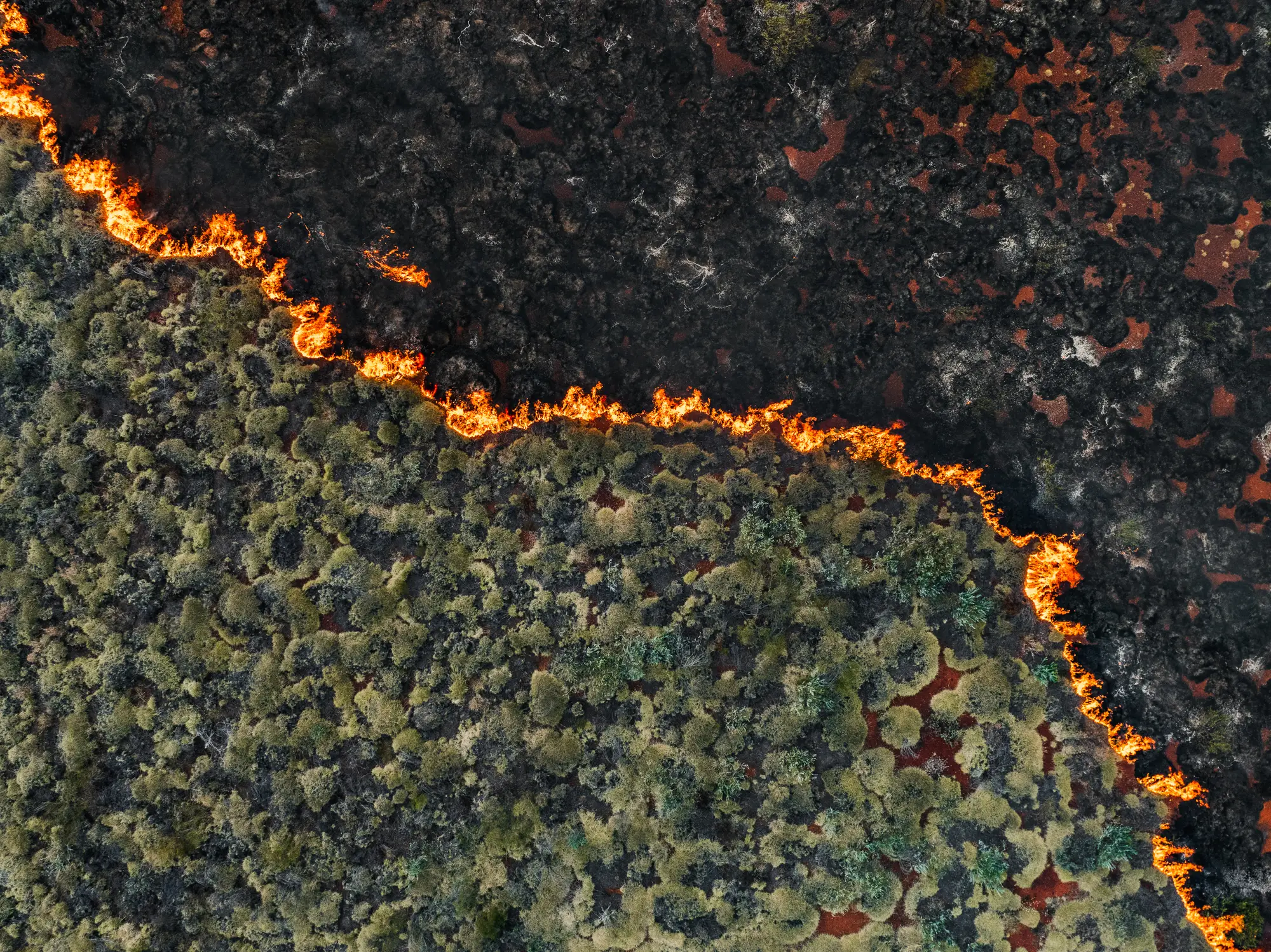
Wildfires
“For the summer, a consequence of El Niño will be a hotter and drier pattern in the Northwest U.S. that can lead to large wildfires,” said Merrill. “Additionally, severe drought can expand across more of the Northwest into the northern part of the Rockies during El Niño summers that transition to a strong to very strong El Niño by the fall to early winter.”
However, then there might be a totally opposite issue.
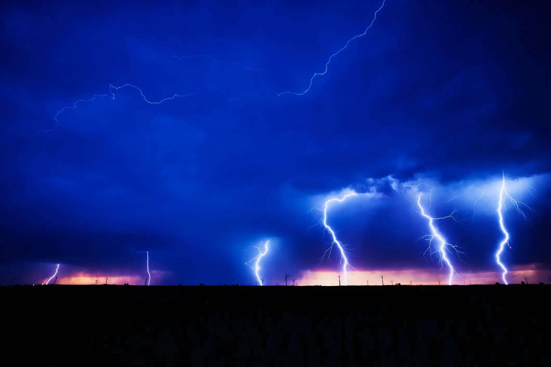
Thunderstorms
Where there is sunshine, rain is soon to follow.
But when it comes to an El Niño, this can be much more menacing than a usual sprinkle of water.
According to Merrill, El Niño could end up joining forces with a marine heat wave off the West Coast to then create more thunderstorms than what’s usual for the area.
The meteorologist said that while they’ll first show up as dry thunderstorms in mid to late June that could spark wildfires, by the end of summer, they could then cause flash floods to local areas.
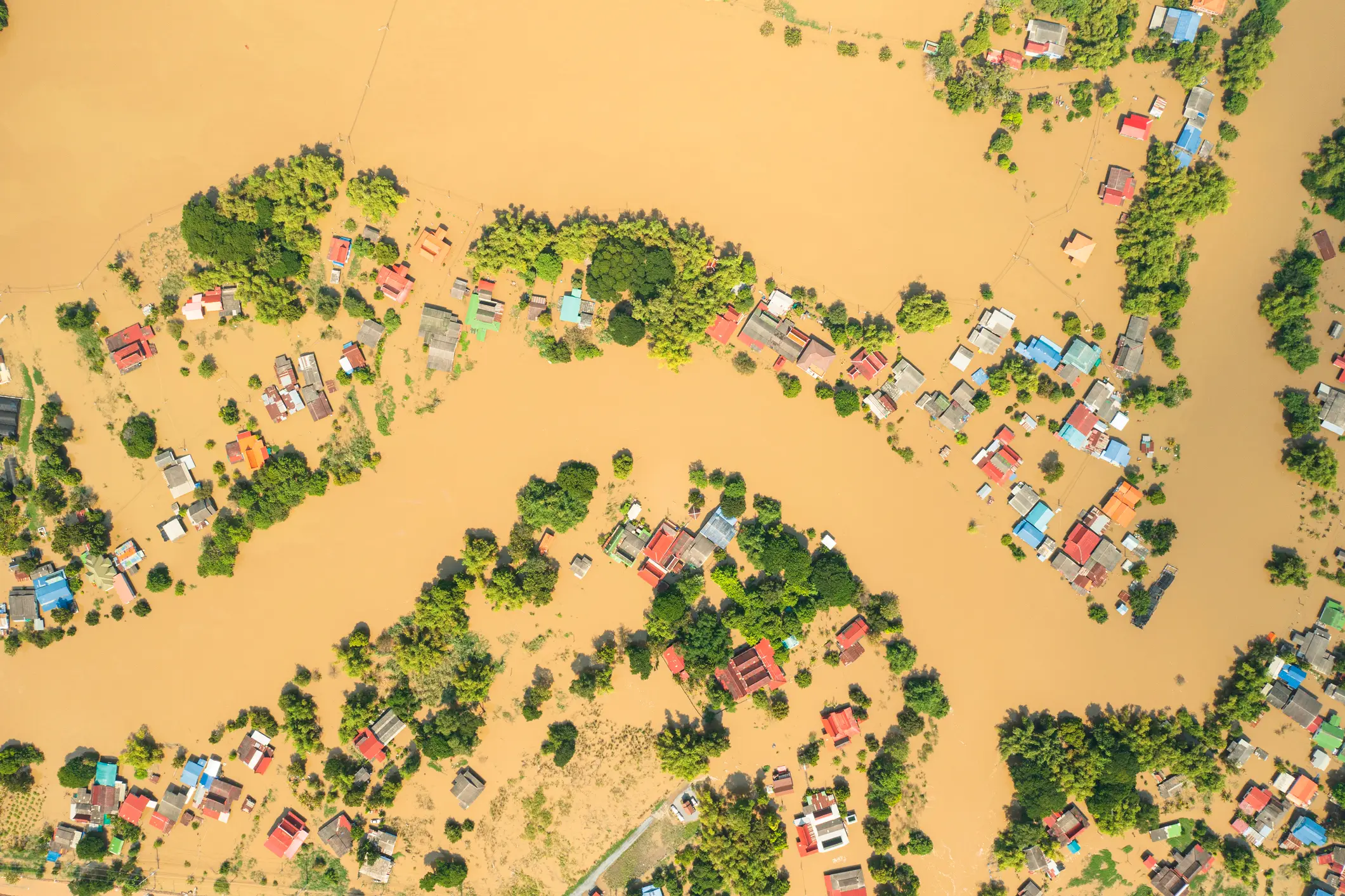
Flash floods
The expert explained that there might be a flash flooding risk after a summer of drought, with the end of July and August being the potential time when it could impact areas like the West Coast and Southern California.
“A heightened East Pacific hurricane season combined with the warm water off the West Coast can lead to tropical downpours inundating southern California and the Southwest from mid to late summer into the early fall season. This can lead to the potential of larger-scale flash flooding,” explained Merrill.
He added: “Repeated rounds of heavy rain through much of the summer can lead to flooding problems. This includes northern Texas to southeast Nebraska, Iowa, Illinois, Indiana, Ohio and even western Pennsylvania.”
The Plains and Midwest also face potential downpour and flash flooding too, according to the expert.