Chilling footage from space shows massive size of typhoon posing 'extremely dangerous threat' to US islands
Topics: Climate Change, International Space Station, US News, Weather
 Ben Williams
Topics: Climate Change, International Space Station, US News, Weather
A powerful typhoon has rapidly intensified in the Pacific Ocean, prompting urgent warnings as it moved towards vulnerable island communities.
Super Typhoon Sinlaku formed southeast of Guam and quickly strengthened into a Category 5 storm, with meteorologists closely monitoring its development as weather conditions allowed it to intensify at speed.
Warm ocean waters and low wind shear helped fuel the cyclone system, pushing it to extreme wind speeds and placing the US Northern Mariana Islands directly in its path.
Officials warned the storm would pose an ‘extremely dangerous threat’ to the region as it approached, with residents urged to prepare for severe conditions.
Advert
Those warnings came as Sinlaku continued to strengthen, becoming one of the most powerful typhoons recorded so early in the year.
It was only after reaching peak intensity that footage began to emerge showing the storm from a completely different perspective.

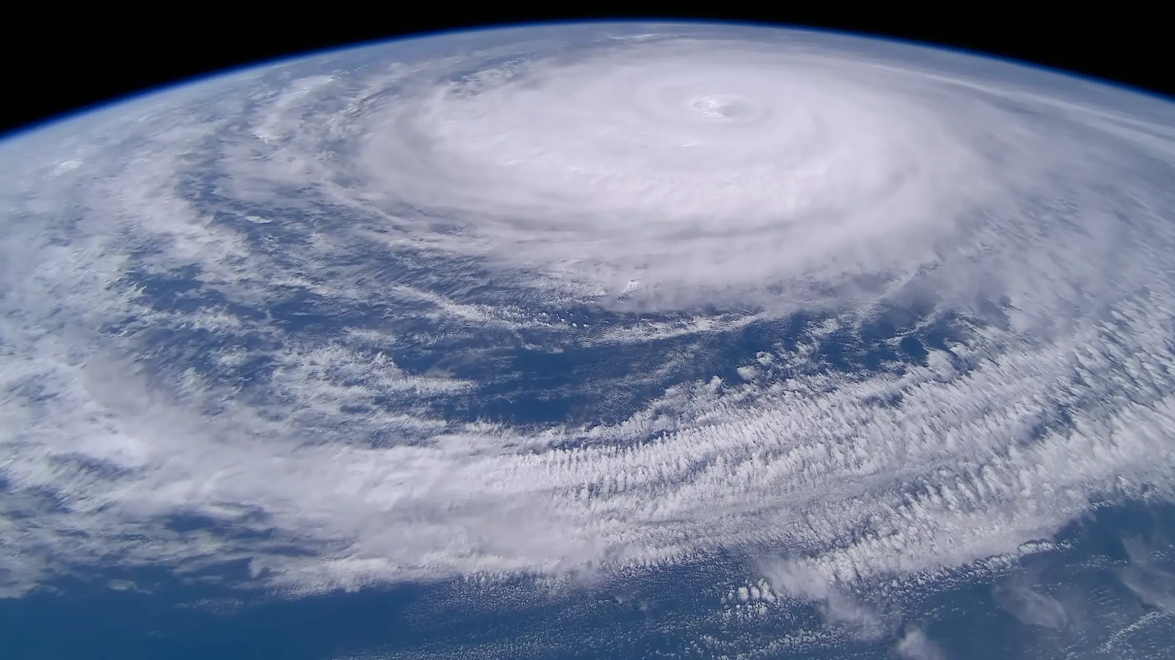
Captured from space, with the footage on YouTube recorded using Sen’s cameras on the International Space Station, the images reveal the immense full scale of the typhoon, with a vast swirling system stretching across the ocean and a clearly defined eye at its centre.
Whilst the structure looks neatly arranged, with dense cloud bands spiralling outwards in near-perfect symmetry (a feature typically associated with the strongest tropical cyclones), it doesn’t take away the sheer magnitude of its size.
Although the view from above appears almost still, conditions on the ground were anything but.
Sinlaku went on to pound the islands of Saipan and Tinian, home to around 50,000 people, bringing ferocious winds and relentless rain that caused widespread disruption.
Roofs were torn from buildings, trees were uprooted, and vehicles overturned as the storm battered communities for hours.
One resident said, as reported by NPR: “I hope people will take an interest and help. The damage is really huge here,” one resident said.
Preliminary reports also indicated flooding, downed power lines, and structural damage across affected areas, with authorities warning residents to remain indoors as conditions remained dangerous.
The storm was packing sustained winds of up to 150mph when it made landfall, with stronger gusts recorded as it passed close to the islands.
Despite the scale of the storm, there were no immediate reports of fatalities, something officials attributed to early warnings and residents taking shelter.
More than 1,000 people were housed in emergency shelters across Guam and the Northern Mariana Islands as the typhoon moved through the region.
Experts have pointed to the rapid intensification of the storm as a key concern, with Sinlaku gaining strength dramatically within a 24-hour period.
Storms of this intensity are uncommon at this stage of the year, raising questions about shifting weather patterns and the conditions that allow such systems to develop.