Featured Image Credit: Justin Merriman/Bloomberg via Getty Images
Parts of the US are set to be battered once more this weekend as a 'bomb cyclone' snowstorm closes in.
If you thought the bleak winter conditions were winding in as February approaches, then I'm afraid it's bad news.
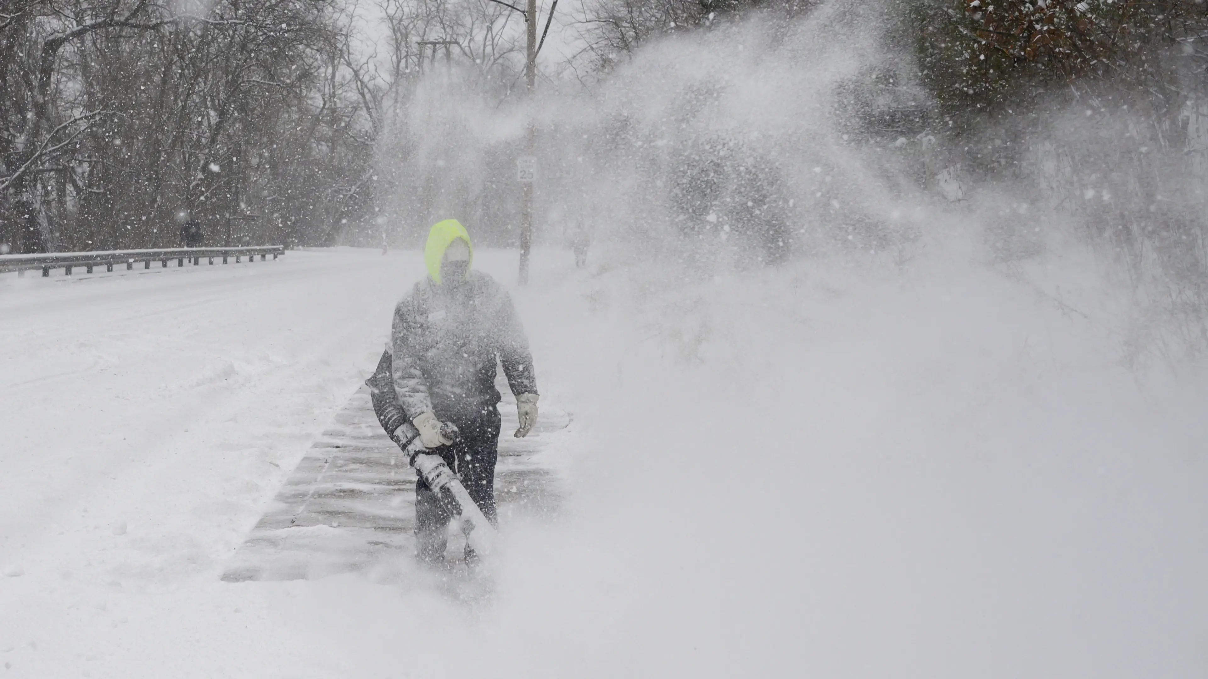
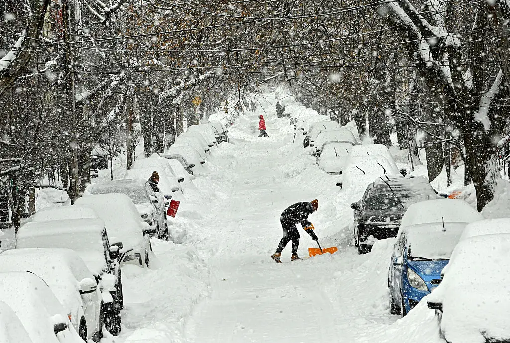
Days after a major storm brought up to 30 inches of the white stuff and left multiple people dead, states across the East Coast and the Mid-Atlantic are being told to 'prepare.'
AccuWeather has warned of the 'possibility of dangerous blizzard conditions,' with the tail-end of the storm traveling as far south as Florida.
Advert
Forecasters have predicted heavy snow, blizzard conditions, strong winds, coastal flooding and extreme cold from Friday (January 30), beginning in southern Ohio and the Tennessee Valley.
By Saturday (January 31), the storm is expected to rapidly intensify offshore, bringing heavy snow and strong winds to the Mid-Atlantic.
As the Weather Channel explains, the storm will be classified as a 'bomb cyclone' if 'the central pressure of a low-pressure system dropping at least 24 millibars within 24 hours'.
It's being driven by a jet stream stuck in a pattern pulling Arctic air deep into the US, worsening by lingering cold air from existing snow cover, as the BBC explains.
Some states may see temperatures drop 59F (15°C) below the time-of-year average, the publication adds.
Here's what to expect across the US this weekend.
The Sunshine State might be famed for its subtropical climate and mild winters, but even Floridians will need to layer up this weekend.
While no major snow is forecast, some flurries could fall in places like Tampa.
Some areas could see record-breaking cold temperatures this weekend, as National Weather Service Ana Torres-Vazquez told ABC News.
“It looks like temperatures across South Florida are dipping into the 30s (F) for most of the metro area and maybe into the 20s for areas near Lake Okeechobee," she said.
Windchill might make these temperatures feel even colder.
Between six and 15 inches of snow is possible across North Carolina and Virginia.
AccuWeather meteorologist Alex Sosnowski said cities such as Charlotte, Raleigh and Greensboro, North Carolina, could be in for their 'biggest snowstorm in decades'.
Meanwhile, the National Weather Service (NWS) predicts 8.4 inches of snow in Raleigh, 7 inches in Greensboro and 6 inches in Charlotte.
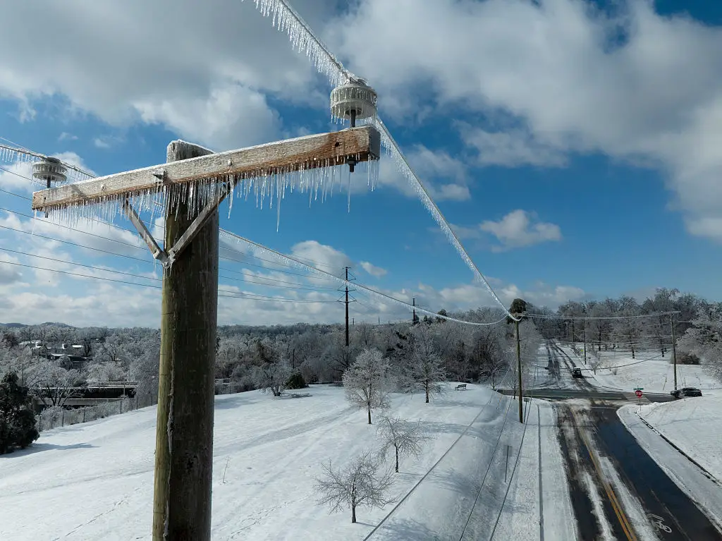
Strong winds and snow could cause more power outages yet and make travel 'dangerous or even impossible,' it adds.
Country roads might not be taking anyone home in eastern West Virginia this weekend.
The NWS reports that snow is likely across North Georgia, eastern West Virginia, South Carolina, and Tennessee.
That's not all; strong winds are also forecast, with the potential to knock down trees and power lines, causing travel disruption.

Coastal areas of Delaware, New Jersey and Maryland could see light snowfall this weekend, but strong winds are expected to be the bigger threat.
Forecasts suggest up to 2 inches of snow in Ocean City, Maryland, and around 1 inch in Dover, Delaware and Atlantic City, New Jersey.
The National Weather Service has warned that strengthening north to northeast winds could bring coastal flooding on Sunday (February 1), with near hurricane-force gusts combining with high tides along the Mid-Atlantic coast.
By Sunday, the storm could shift northwards, impacting major north-east cities such as New York and Boston, the BBC reports.
However, it's still uncertain just how far inland heavy snow might reach.
The most likely zone for between 6 and 12 inches of snow in the Northeast is southeastern Massachusetts, specifically Cape Cod, Martha’s Vineyard and Nantucket, Weather.com meteorologists Rob Shackelford and Jonathan Erdman say.