Scientists discover structure under Pacific ocean linked to 'Super El Niño' forming at a rapid rate

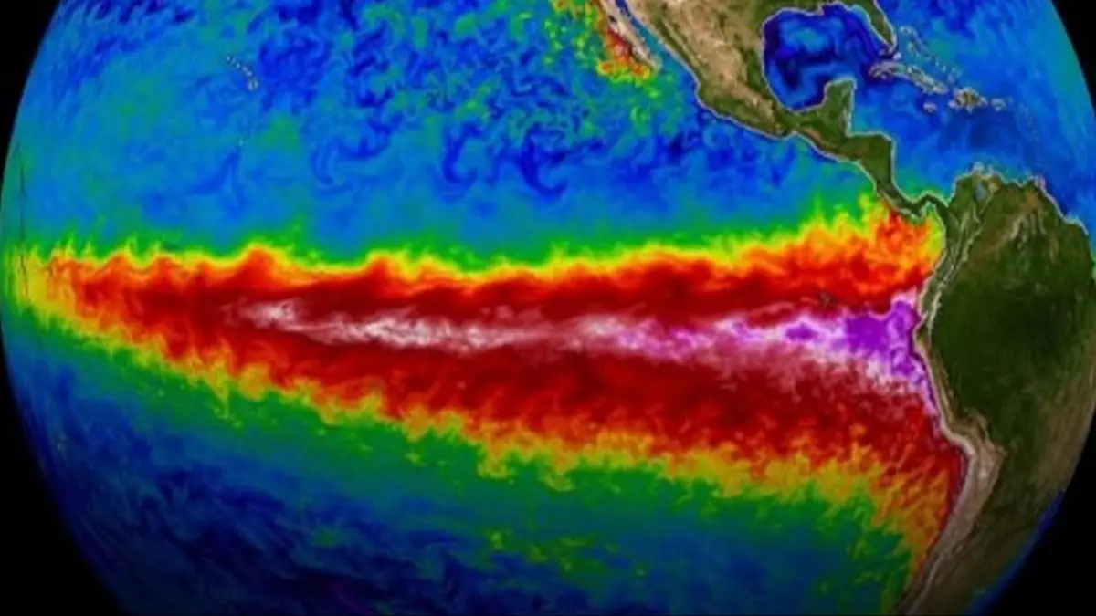
Scientists have discovered a new structure developing underneath the Pacific Ocean which they claim is responsible for this year’s El Niño weather pattern.
Experts say they have pinpointed an incredibly warm undersea structure, known as a Kelvin wave, forming at rapid rates beneath the Pacific Ocean.
The enormous pool of warm water is currently carrying temperatures up to 13.5 degrees Fahrenheit above average, and could be responsible for some of the hottest weather ever recorded.
A 'super El Niño' happens when ocean surface temperatures in the Pacific rise a minimum of 3.6 degrees Fahrenheit above the long-term average.
Advert
They shift large-scale global weather patterns, leading to an increased likelihood of both hotter, record-breaking summer temperatures and colder, windier winter weather.
Michelle L’Heureux, a researcher with the National Oceanic and Atmospheric Administration’s Climate Prediction Center, told the Wall Street Journal: "The current Kelvin wave is impressive and, by some measures we look at, it is rivaling the one we saw in 1997."
And the magnitude of a Kelvin wave, ahead of El Niño, can tell us a lot about the warming period to come.
The first super El Niño happened in 1877, a devastating event which resulted in widespread droughts and famines that killed an estimated 50 million people across the world.
And the latest was experienced between 2015-2016, which directly contributed to outbreaks of diseases like the Zika virus, cholera, hantavirus, chikungunya, and more.
The US National Oceanic and Atmospheric Administration (NOAA) says there is an 80 percent chance of El Nino developing by July 2026.
And speaking to AFP, Adam Scaife, head of long-range prediction at the UK Met Office, said this event could be the strongest in decades, or 'even be of record strength'.
He added: "There's definitely something coming. We're very confident about that, and it looks like it will be a big event."
But the warning didn't stop there.
"The impacts of this El Nino - on things like rainfall and of course temperature - are riding on top of climate change, and could well be larger than anything we've seen in the past," Scaife further noted.
And due to climate change, what happened during an El Nino event 20 years ago is likely to be quite different to how it would show up in 2026.
L’Heureux added: "Ultimately the strength of this event will be likely influenced by details, like the low-level winds, which we cannot predict many months in advance."
Topics: Science, Environment
 Mia Williams