Residents left baffled after mysterious roll clouds stretching hundreds of miles appear in the sky
Rare roll clouds have left Sydney residents baffled, after they can be seen stretching for hundreds of miles.
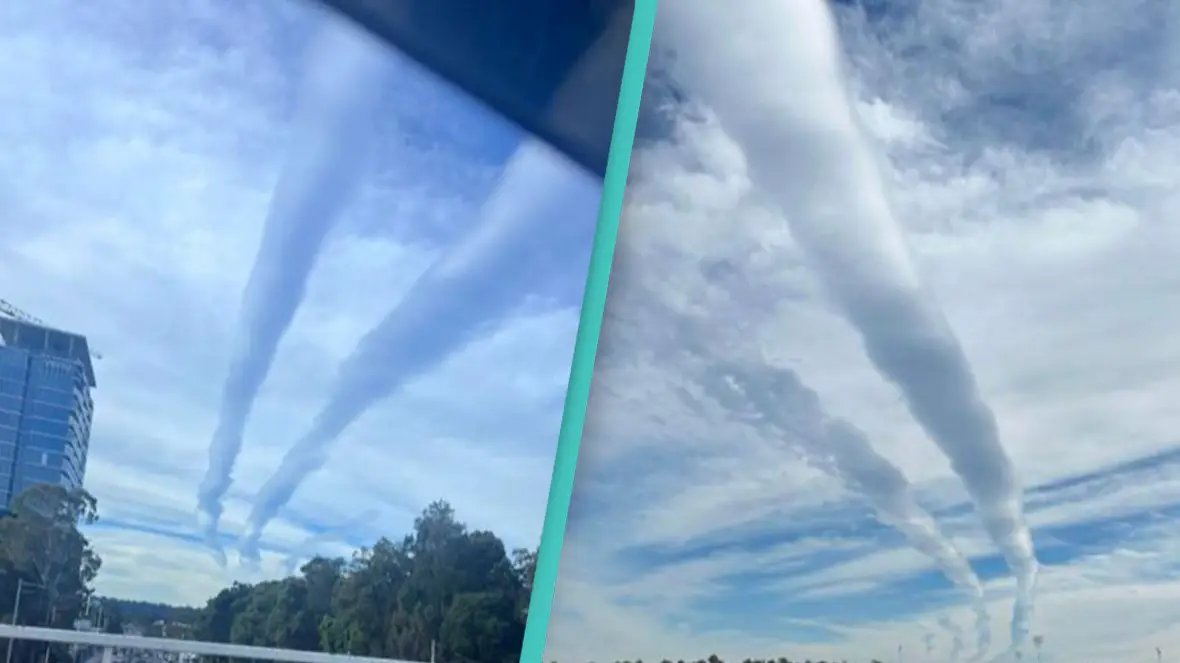
Residents across Sydney, Australia, have been left confused after seeing tube-like clouds in the sky around 11:30 am on Tuesday.
The unusual and rarely seen clouds moved in an easterly direction around 3pm, and seemingly disappeared.
The bizarre formation stretched across skies for 300km, from the Southern Highlands all the way to Nelson's Bay in the very north.
Advert
Baffled residents across Greater Sydney took to social media to make sure they weren’t the only ones seeing the roll clouds.
One person on X (formerly Twitter) said: “This cloud has been slowly rolling its way across Sydney for the last couple of hours.
“Must be at least 100 km long, amazing.”
Another said: “Sydney clouds are currently going wild out here.”
Sydney’s 7NEWS weather reporter Angie Asimus said: “In a westerly wind pattern, the air rises and cools as it goes over the mountains and then cools and condenses on the way down.
“The rise and fall creates these long clouds.
“These (clouds) can also be a sign of turbulence for aircraft.”
Some were left highly confused after never hearing or seeing them before.
Roll clouds are long, tube-like clouds which are extremely rare to see.
What makes them unique, is that they are completely separate from other cloud features.
They form when wind shear across a horizontal boundary leads to uplift, and consequently cloud formation, as well as being confined to a shallow vertical slab of air.
This complicated recipe for creation is why they are so rarely seen.
One person on X questioned just how rare the clouds actually are, saying: “Has anyone ever seen this before in their long years alive?
“This atmospheric gravity wave produced clouds?
“I’m keen to know.”
But others noted that the clouds resembled a popular conspiracy theory known as ‘chemtrails’.
This theory suggests that the government is pumping toxic chemicals into the atmosphere through aircrafts.
They said: “Would have to say they look suspiciously like a chemtrail trapped by surrounding cold air, causing the chemicals to band together in a cylindrical formation due to wind currents.”
The most famous and most regular roll cloud can be seen over Cape York Peninsula.
It’s called the Morning Glory, and it forms when sea breezes collide from the Gulf of Carpentaria and northern Coral Sea.
Topics: Science, Weather, World News, Nature, Australia