• News
  • Film and TV
  • Music
  • Tech
  • Features
  • Celebrity
  • Politics
  • Weird
  • Community
  • Advertise
  • Terms
  • Privacy & Cookies
  • LADbible Group
  • LADbible
  • SPORTbible
  • GAMINGbible
  • Tyla
  • UNILAD Tech
  • FOODbible
  • License Our Content
  • About Us & Contact
  • Jobs
  • Latest
  • Topics A-Z
  • Authors
Facebook
Instagram
X
Threads
TikTok
YouTube
Submit Your Content
NASA map reveals chilling impact of US cities with 40,000,000 people sinking into the ocean

Home> Technology> NASA

Updated 21:07 10 Mar 2025 GMTPublished 21:03 10 Mar 2025 GMT

NASA map reveals chilling impact of US cities with 40,000,000 people sinking into the ocean

'In many parts of the world land is moving down faster than the sea itself is going up,' explained the lead author of the study

Joe Yates

Joe Yates

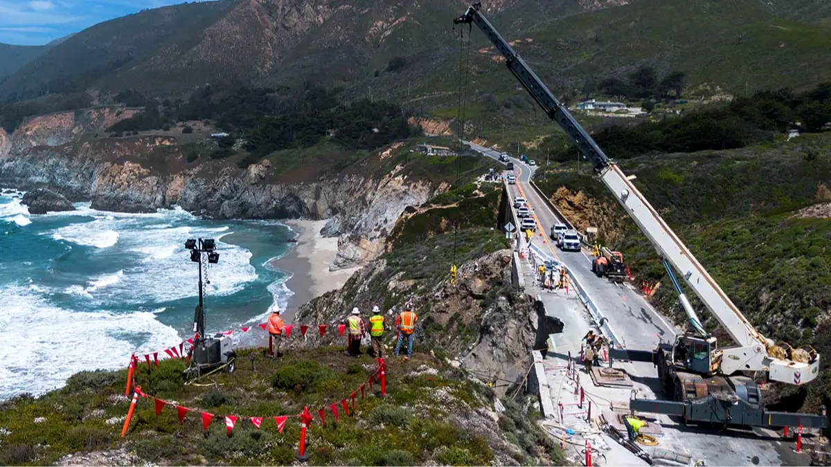
Parts of California are sinking at an alarmingly fast rate, due to both subsidence and rising sea levels.

A NASA-led team of scientists has analyzed the US' most populous state, which is home to just under 40 million residents, and has estimated that sea levels could rise by as much as 17 inches by 2050 - that's 1.4ft.

“In many parts of the world, like the reclaimed ground beneath San Francisco, the land is moving down faster than the sea itself is going up,” explained lead author Marin Govorcin, a remote sensing scientist at NASA’s Jet Propulsion Laboratory in Southern California.

Researchers from NASA's Jet Propulsion Laboratory, from the California Institute of Technology, as well as the National Oceanic and Atmospheric Administration (NOAA), tracked California's coast line through by using satellite radar and highlighted the hot spots.

Advert

A bike path is seen covered in ocean water during the 'King Tide' in Mill Valley, California in 2022. 'King Tides' occur when the Earth, moon, and sun align in orbit to produce unusually high water levels (JOSH EDELSON/AFP via Getty Images)

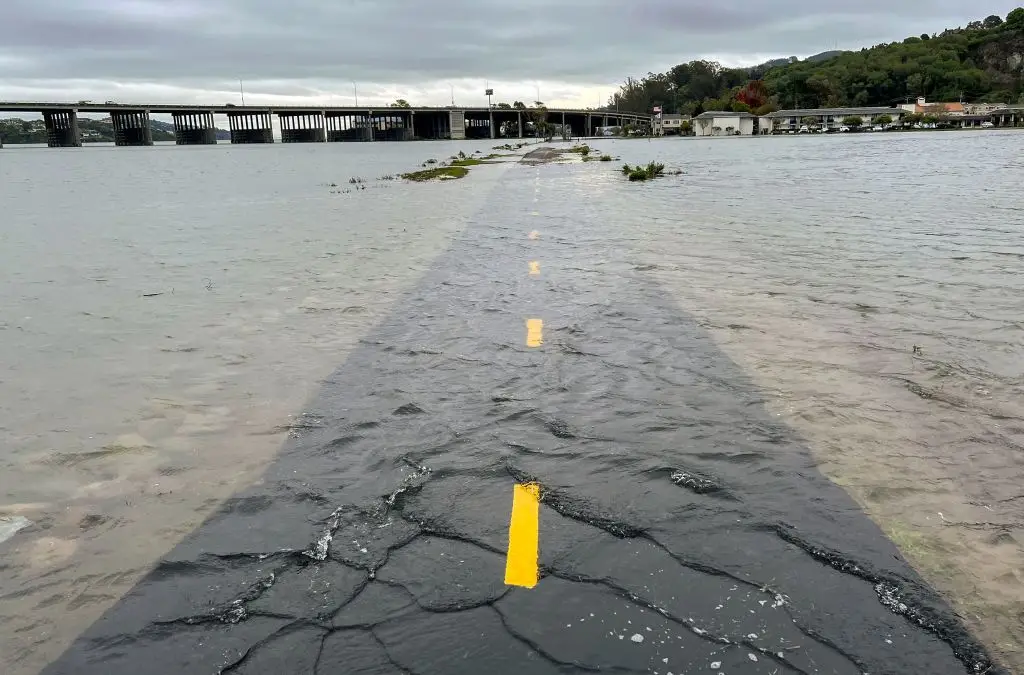
In the San Francisco Bay Area, more specifically, San Rafael, Corte Madera, Foster City, and Bay Farm Island, they found that the land was subsiding at a rate of more than 0.4 inches (10 millimeters) every year.

Due to this subsidence, the lowest-lying parts of these areas could see sea levels rise by more than 17 inches by 2050.

The team published the study in Science Advances. The abstract read: "Coastal vertical land motion (VLM), including uplift and subsidence, can greatly alter relative sea level projections and flood mitigations plans.

Advert

Scientists mapped land sinking in coastal California cities (NASA)


"Yet, current projection frameworks, such as the IPCC Sixth Assessment Report, often underestimate VLM by relying on regional linear estimates.

"Using high-resolution (90-meter) satellite data from 2015 to 2023, we provide local VLM estimates for California and assess their contribution to sea level rise both now and in future."

Advert

It continued: "Our findings reveal that regional estimates substantially understate sea level rise in parts of San Francisco and Los Angeles, projecting more than double the expected rise by 2050.

Cliffs in San Simeon, California, slope into the ocean (NASA/JPL-Caltech)

"Additionally, temporally variable (nonlinear) VLM, driven by factors such as hydrocarbon and groundwater extraction, can increase uncertainties in 2050 projections by up to 0.4 meters in certain areas of Los Angeles and San Diego.

"This study highlights the critical need to include local VLM and its uncertainties in sea level rise assessments to improve coastal management and ensure effective adaptation efforts."

Advert

The team of researchers also projected that humans are also inducing local land motion which can increase uncertanties in sea level projections by as much as 15 inches every year, specifically in parts of the counties of Los Angeles and San Diego.

Featured Image Credit: Melina Mara/The Washington Post via Getty Images

Topics: Climate Change, NASA, California

Joe Yates
Joe Yates

Joe is a journalist for UNILAD, who particularly enjoys writing about crime. He has worked in journalism for five years, and has covered everything from murder trials to celeb news.

X

@JMYjourno

Advert

Advert

Advert

Choose your content:

2 days ago
3 days ago
  • Getty Images/Justin SullivanGetty Images/Justin Sullivan
    2 days ago

    People have already noticed flaw with new iPhone as Samsung savagely troll Apple

    Samsung had things to say about the new iPhone Air

    Technology
  • NASA Mars TwitterNASA Mars Twitter
    2 days ago

    NASA reveals significant new evidence that shows potential signs of previous life on Mars

    NASA are waiting for the sample mission green light

    Technology
  • YouTube/NewsNationYouTube/NewsNation
    3 days ago

    Unsettling footage shown to Congress of mysterious orb being shot by US Hellfire missile and ‘bouncing right off’

    An investigative journalist claimed there was a 'bank' of similar footage out there that Congress had yet to see

    Technology
  • M. Jäger and Gerlad RhemannM. Jäger and Gerlad Rhemann
    3 days ago

    Harvard scientist speaks out after mysterious space object heading our way appears to suddenly change color

    A mysterious visitor from beyond our solar system is changing color, and scientists are racing to figure out why

    Technology
  • NASA reveals significant new evidence that shows potential signs of previous life on Mars
  • Horrifying map shows the surprising areas in US which are most at risk of wildfires
  • Devastating impact oil tanker bursting into flames after colliding with cargo ship could have on environment
  • Oceans are getting darker and it could have a huge impact on life on Earth