Hiker left stranded on cliff after following fake Google Maps trail
Topics: News, World News, Canada
 Kit Roberts
Topics: News, World News, Canada
You might think that Google Maps is entirely beyond reproach, but it's always worth taking it with a pinch of salt.
This isn't to say that the service isn't extremely reliable a lot of the time, but sometimes things can go very wrong indeed.
Whether it's when you arrive at a roundabout and only find out which exit you're supposed to take when you're on your third circuit, or even worse being stranded somewhere remote.
And that's what one hiker found while out in Canada.
Advert
He had been following what he believed to be a proper trail in British Columbia which turned out not to be real at all.
While things getting mixed up would be frustrating in a city, in a place like this it could end up being potentially deadly.
And this is not a bit of the wilderness which is exactly safe either, at least not according to the North Shore Rescue, or NSR.
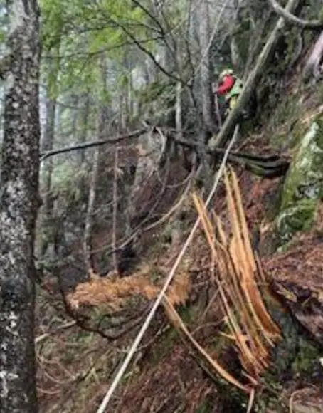
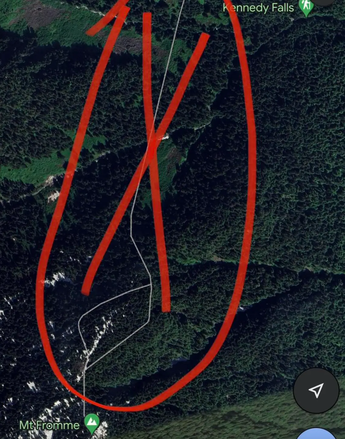
In a statement put out on Facebook, they said: "To be clear, the area in question has no trails and is very steep with many cliff bands throughout.
"In the preceding weeks, NSR has actually placed signage in the area warning of this.
"The area is clearly dangerous, as it was the sight of a previous fatality."
So, basically not the sort of place that you would want to get lost in.
The hiker had been trying to reach the summit of Mt. Fromme, a peak which is located at a place which is to the north of Vancouver.
Unfortunately during the attempt he found himself stranded on the mountainside on November 4 and unable to get back down the way he came.
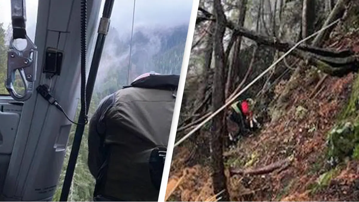
Rescuers were dropped down into a wooded area and were able to reach him and bring him to safety.
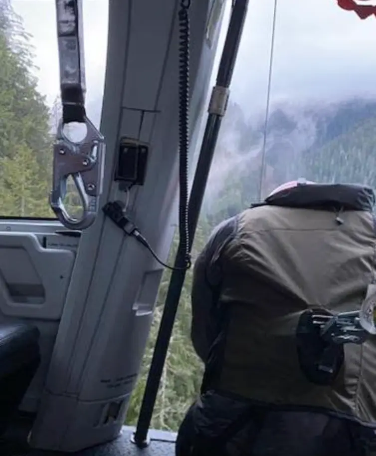
They were then picked up by a helicopter.
Rescuers reported that the hiker had only very minimal equipment, including unsuitable footwear for the trek he was attempting, as well as not having a flashlight.
The hiker, who has not been named, was not the first person who rescuers have had to bring back from this location.
In fact, he is the second in two months to have been recovered, with rescuers believing that both incidences were the result of Google Maps displaying a false trail in the area.
In reality no such trail exists.
In an update, NSR said that Google Maps has since removed the fake trail.
NSR has also advised people to avoid Google Maps for hiking, and instead use specialised apps such as CalTopo or Gaia.
Either that, or just a good old fashioned paper map and a compass. After all, paper maps don't run out of battery.
UNILAD has contacted Google for a comment.