Scientists make groundbreaking discovery at 'underwater Stonehenge' that could rewrite human history
 Dan Seddon
It's been revealed that Lake Michigan sits atop a Stonehenge-esque structure that may reshape our understanding of human history.
Originally discovered 40 feet below the surface of Grand Traverse Bay 18 years ago - scientists were actually seeking out a lost shipwreck at the time - this mysterious 9,000-year-old site consists of enormous stones arranged into a hexagon.
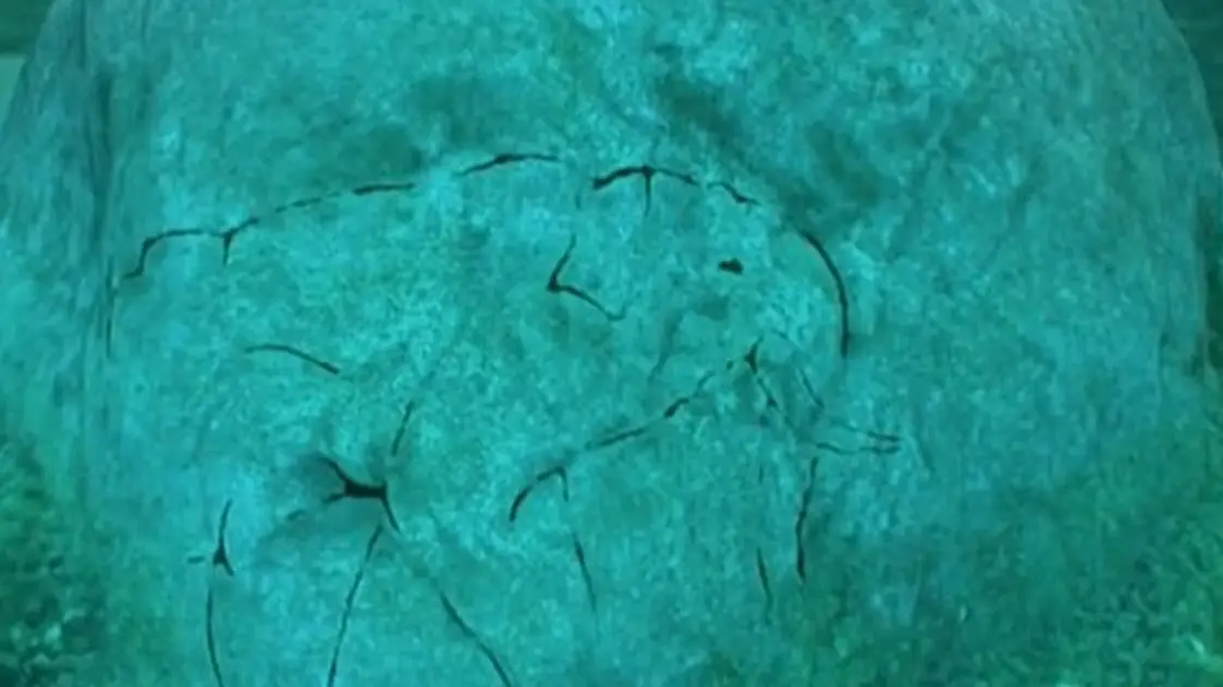
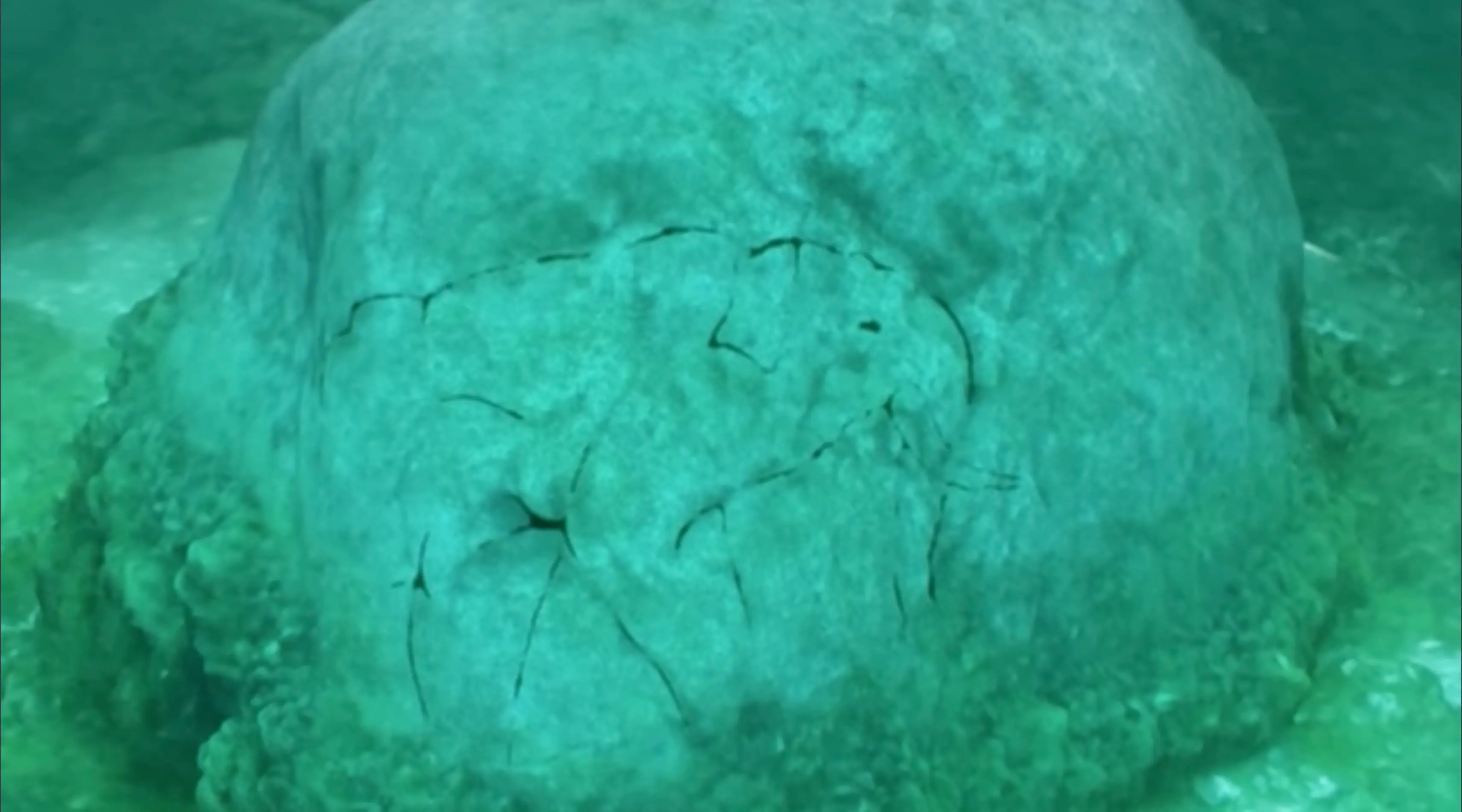
At the time, researchers suspected that a nearby boulder featured animal carvings, and now they've finally identified it as a mastodon (an Ice Age cousin of the elephant and mammoth that died out thousands of years ago).
Using sonar technology, the team discovered that the carving must have been done around 7000 BC, which makes it one of the earliest pieces of prehistoric art found in North America.
Advert
As such, ancient humans were communicating this way far earlier than the previously believed timeline of 4,000 years ago.
Meanwhile, researchers also singled out two granite rings connected to the stones that run over a mile across the lakebed.
Per MailOnline, the University of Michigan's Dr John O'Shea believes these stones acted as a driving lane to direct large animals to their death place - a common practice among prehistoric cultures.
Dr Mark Holley, an adjunct professor of Anthropology at Northwestern Michigan College who made the discovery, was initially amazed by the mastodon, yet knew it would need to be verified.
A number of so-called experts suggested the shape was simply a result of cracking in the rock, but the scanning tech proved them wrong.
The rock in which it's embedded stands at around three-and-a-half feet and five feet across.
At the turn of the year, a team hailing from Northwestern Michigan College used underwater imaging to fully map the area to dictate its true size - ultimately bettering the grainy sonar imagery from 2007 that displayed a rough line of stones but not much else.
Later this summer, Dr Holley's scientific team is set to return to the site in order to extract sediment cores which will confirm exactly when rising lake levels buried it underwater.
Should they discover that the stones were placed there when the land was dry, this would confirm North American human activity thousands of years earlier than previously proven.
Further to that, it would also insinuate that organised societies existed in the Great Lakes region within the early Holocene - building massive structures long before cities, writing, or agriculture appeared elsewhere.
As for other extraordinary geological finds, scientists might have unearthed the final resting place of the biblical Noah's Ark.
They began scanning the mountains of eastern Turkey, roughly 18 miles south of Mount Ararat, which makes sense as this is where the Bible pinpoints the boat's end point, when they made the eureka discovery.
The specific spot is actually the Durupinar site, which not only looks like a boat-shaped mound but measures up to 538 feet long - the same dimensions of the infamous ark that saved humanity and the animal kingdom some 4,300 years ago, reports the New York Post.
Amazingly, their radar equipment even picked up a 13-foot 'tunnel' cutting through the center of the structure, the Daily Mail added, as well as subterranean layers and 'central and side corridors or hallways running through'.
The team thinks this corresponds to the Book of Genesis 6:16, which tells of how saviour Noah was instructed to make 'lower, second and third decks'.