First ever 3D scans of Titanic reveal never-before-seen details
Topics: Science, Technology, Weird, World News, Titanic
Topics: Science, Technology, Weird, World News, Titanic
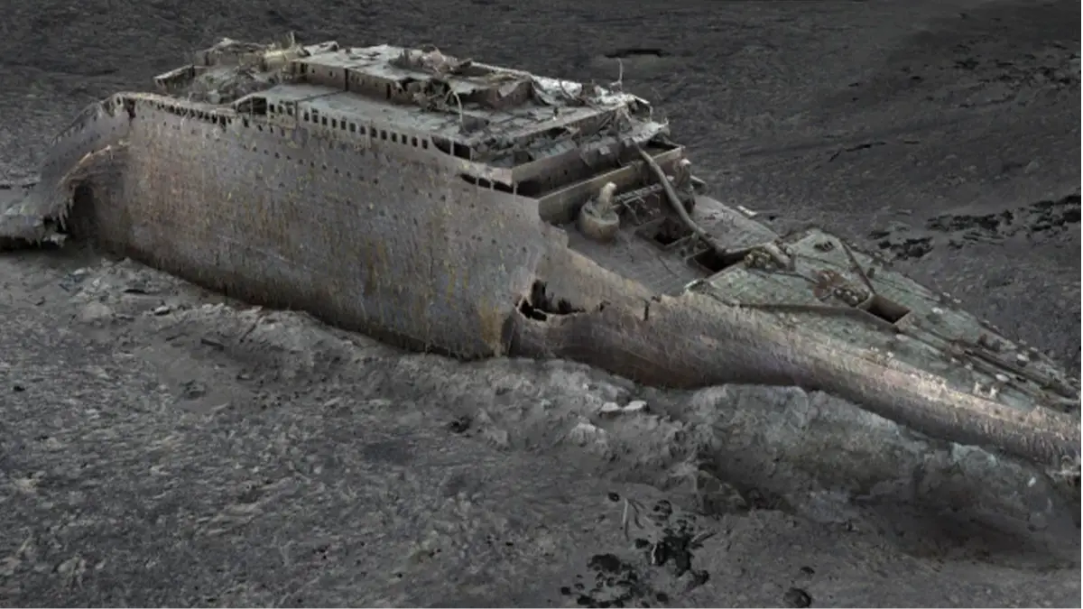
The first ever 3D scan of the wreck of the Titanic has revealed some never-before-seen details about the doomed vessel.
Of course, ‘never-before-seen’ in this instance should come with the caveat ‘since it hit an iceberg and sank 111 years ago’, but you get what we’re talking about here, right?
It’s new to us in 2023, that’s all that matters.
Experts are hoping that this groundbreaking use of technology could give more insight into what happened to the vessel in April 1912, when more than 1,500 people lost their lives after it struck an iceberg.
Advert
Incidentally, that’s not the sort of insight they’re after – they know why it sank, they just want to learn a bit more about the precise details of what happened.
So, they’ve used deep-sea mapping to create a 3D representation of the entire wreck site, which could unlock ‘a century’s worth of human interpretation’ about what happened aboard the ill-fated White Star liner.
According to Titanic expert and historian Parks Stephenson, the new scan is pretty damn good.
“[It] blew me away,” he said.
He called it a ‘major step to driving the narrative of the Titanic towards evidence-based, scientific research and not speculation.’
The scan was made by a company called Magellan, working with Atlantic Productions, who are making a documentary about the project.
In a statement, the company said: “Using the submersible camera systems, the team performed dedicated photogrammetry passes on the wreck, allowing highly accurate and photoreal 3D models of RMS Titanic to be produced.”
Photogrammetry – for those who aren’t aware – is where loads of photographs of something are overlaid before being converted into 2D and 3D models.
When the Titanic went down, it claimed the lives of more than 1,500 people, most of whom were from the lower decks, which is to say, the poorest folks.
The wreck was only found in 1985, about 350 nautical miles from the Canadian coast.
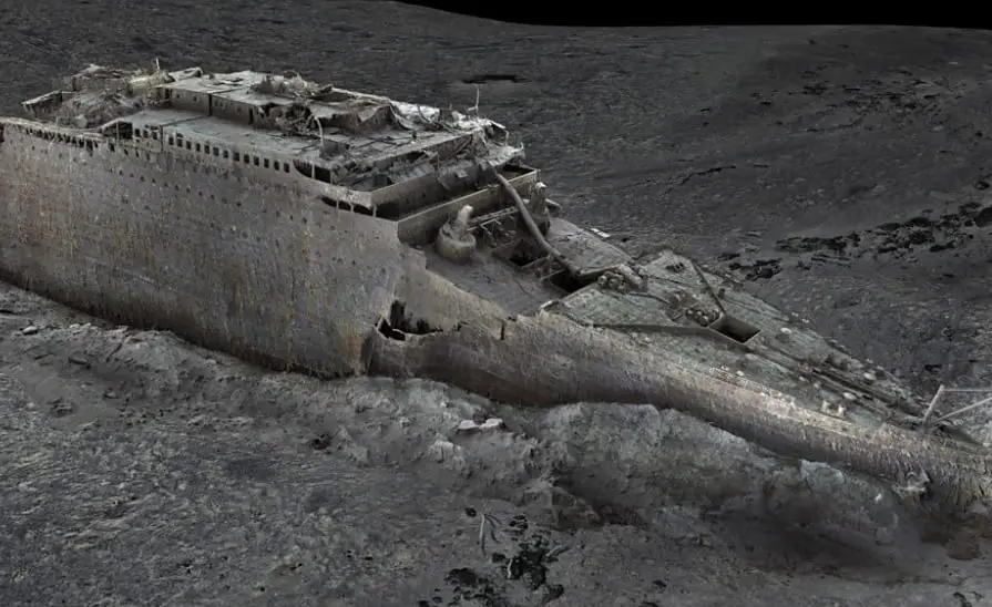
It had broken into pieces as it sank beneath the waves, with two main parts of the wreck around 2,000 feet apart from one another.
There has been footage taken of the wreck before, but – according to Stephenson – the submarine cameras ‘only see small portions of the wreck site at any given moment’.
The idea is that this 3D map will help provide a more complete picture.
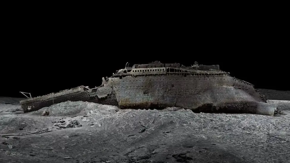
In the past, people have worked based on what the Titanic looked as a complete ship.
However, the problem with this is that if you ‘paint the ship or try to build a model of it, it’s going to have a bias to how it originally looked’.
“It will be accurate but you’ll tend to make it more complete than it actually is,” he added.
This new scan is ‘devoid of that’.
Stephenson explained: “It is completely based on data and not human interpretation and that is why we are now seeing it in its larger context for the first time ever.
“Now we’re getting objective, so we can get really serious with the science of understanding the wreck.”
This development goes beyond the Titanic, too.
Stephenson is ‘absolutely convinced’ that this type of model ‘ushers in a new phase of exploration and analysis’, and will be used ‘not just for Titanic, but for all underwater exploration’.